My favourite works from a 16 day trip on the rugged, remote, and scenic Pamir Highway (M41) and its detours, one of the world's highest official roads, connecting Osh, in Kyrgyzstan, and Khorog, in Tajikistan. 
I hope this gallery offers a glimpse into this stunningly beautiful, yet desolate part of our world.
Starting in Osh, we drove South towards the border, stopping for a couple of days in the Alay Range, the formidable, mountainous border between the two countries, home to Lenin Peak / Ibn Sina, rising to 7,134m. Although shrouded in a storm to begin with, we hiked towards the peak from our Yurt Camp, hoping the forecast would stay true. It did, and with still a couple of light before sunset, the clouds dissipated and revealed the majestic Northern faces of Lenin Peak.
Colourful valleys and snowy mountains of Peak Lenin and Alay Valley, Kyrgyzstan

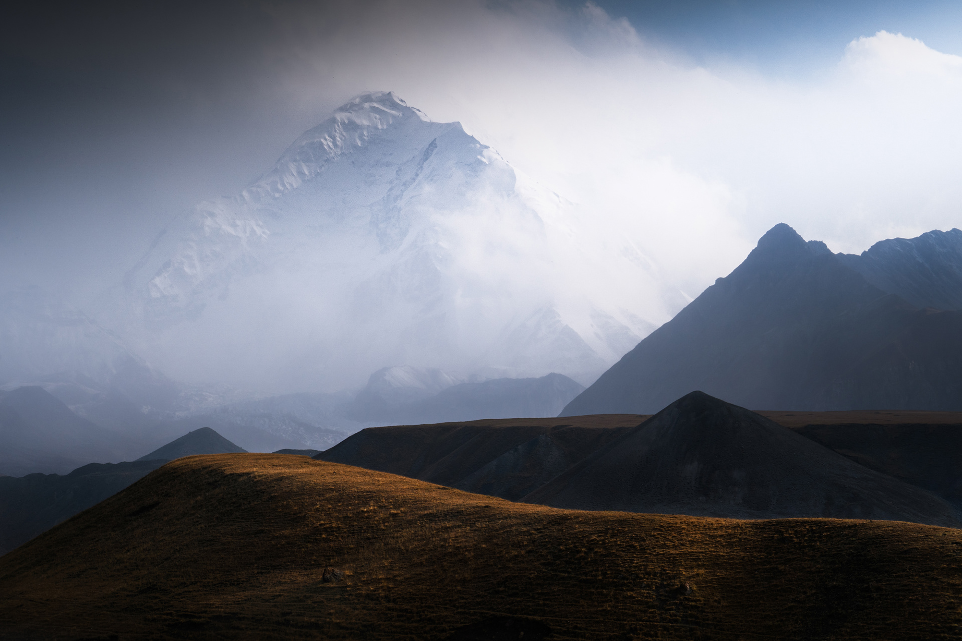
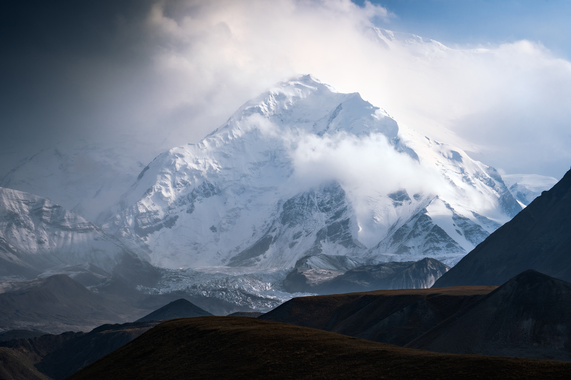
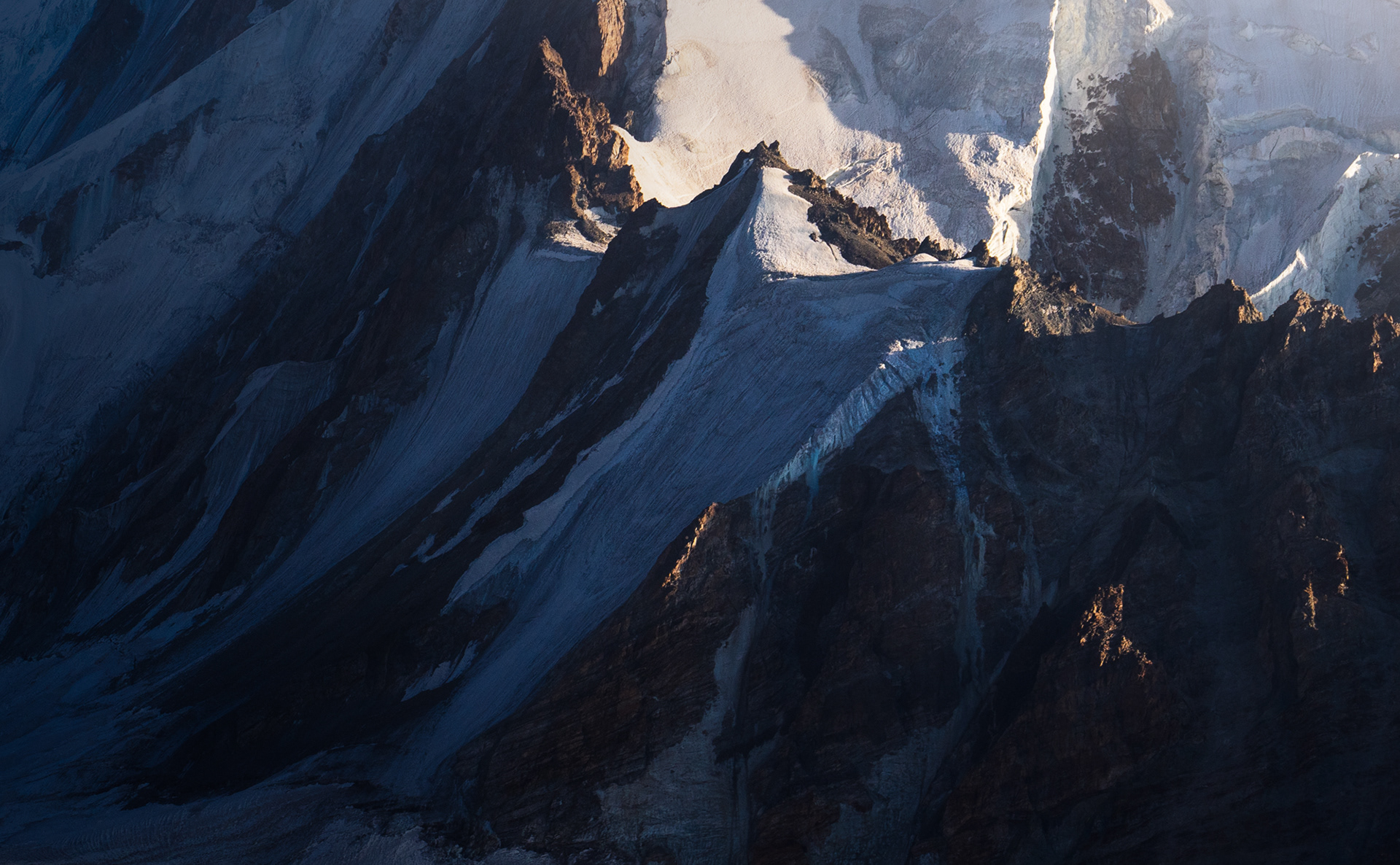
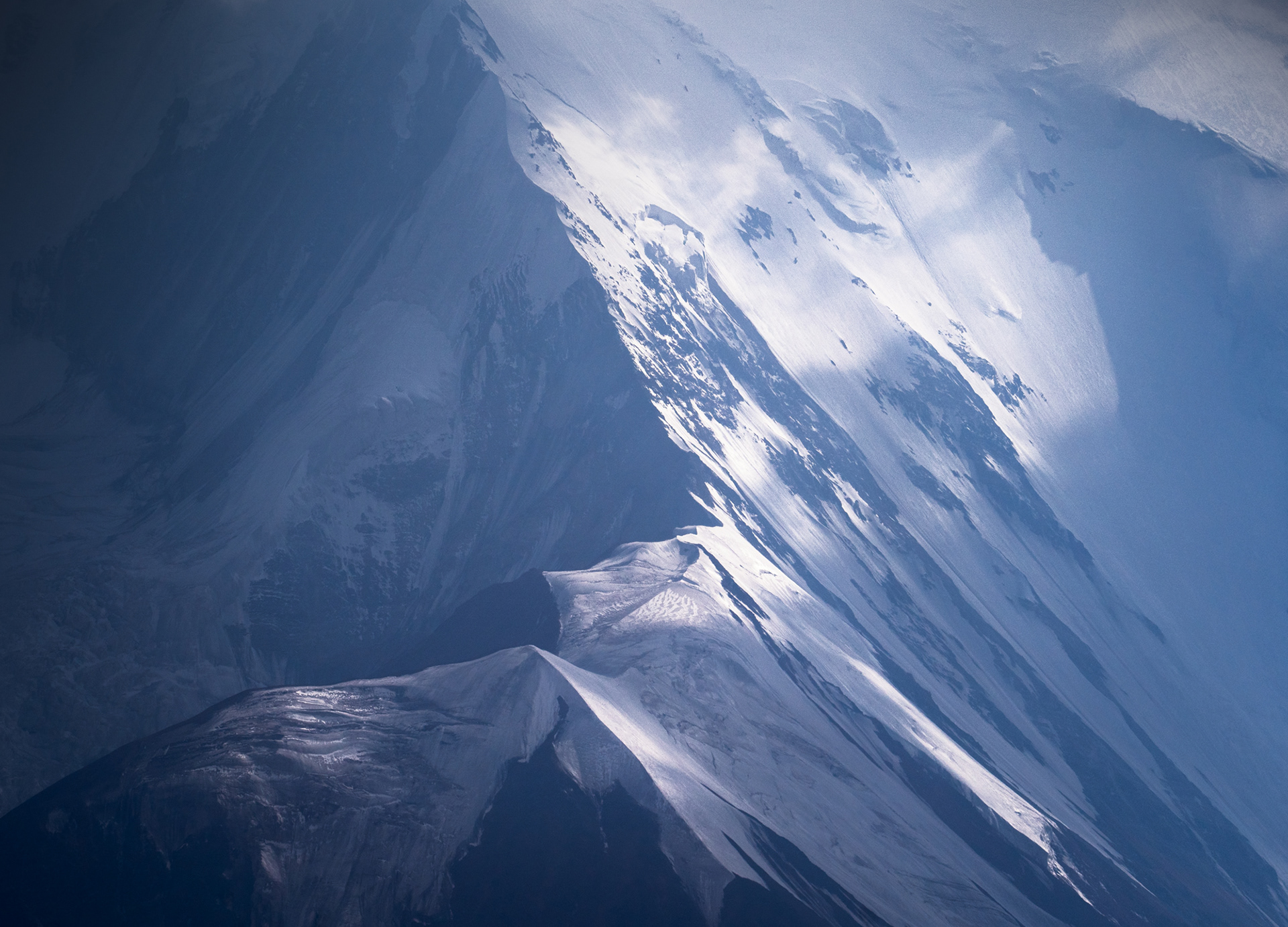
The Lower North Faces of Lenin Peak (7,134m) emerge from a short, but violent storm.

Colourful valleys and snowy mountains of Peak Lenin and Alay Valley, Kyrgyzstan

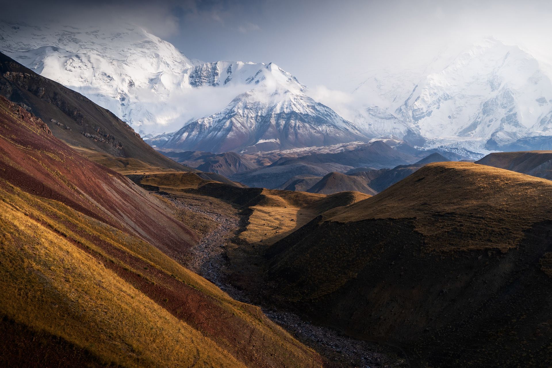
Kaleidoscopic colours of the Alay Valley leading towards the base of Lenin Peak.

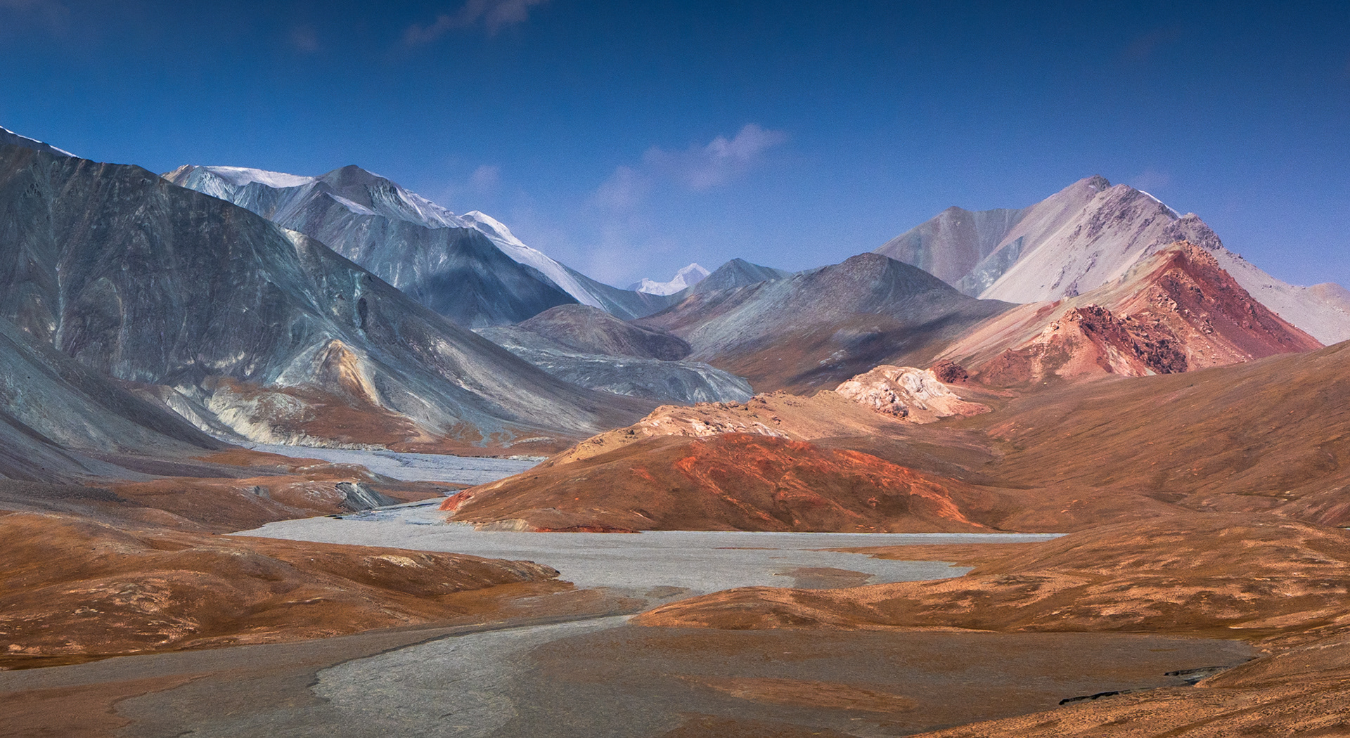
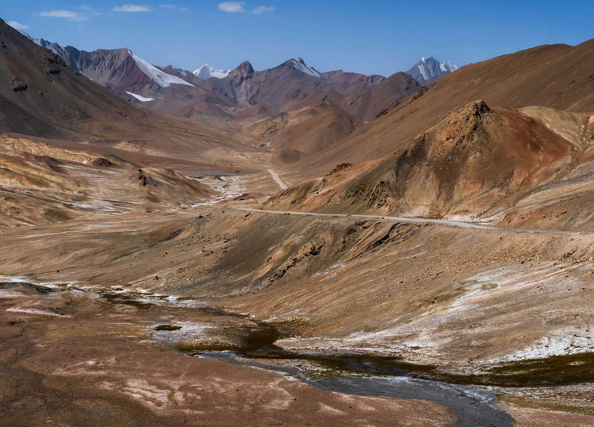
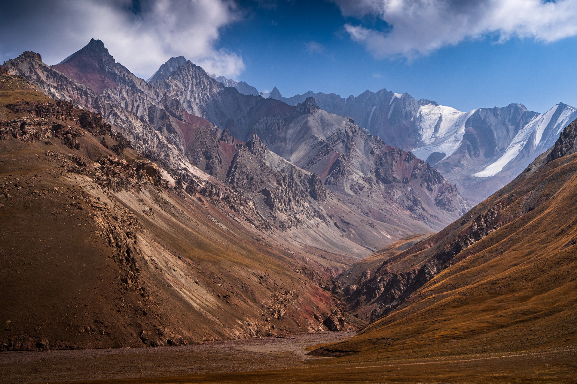
Looking back towards the Alay Valley.
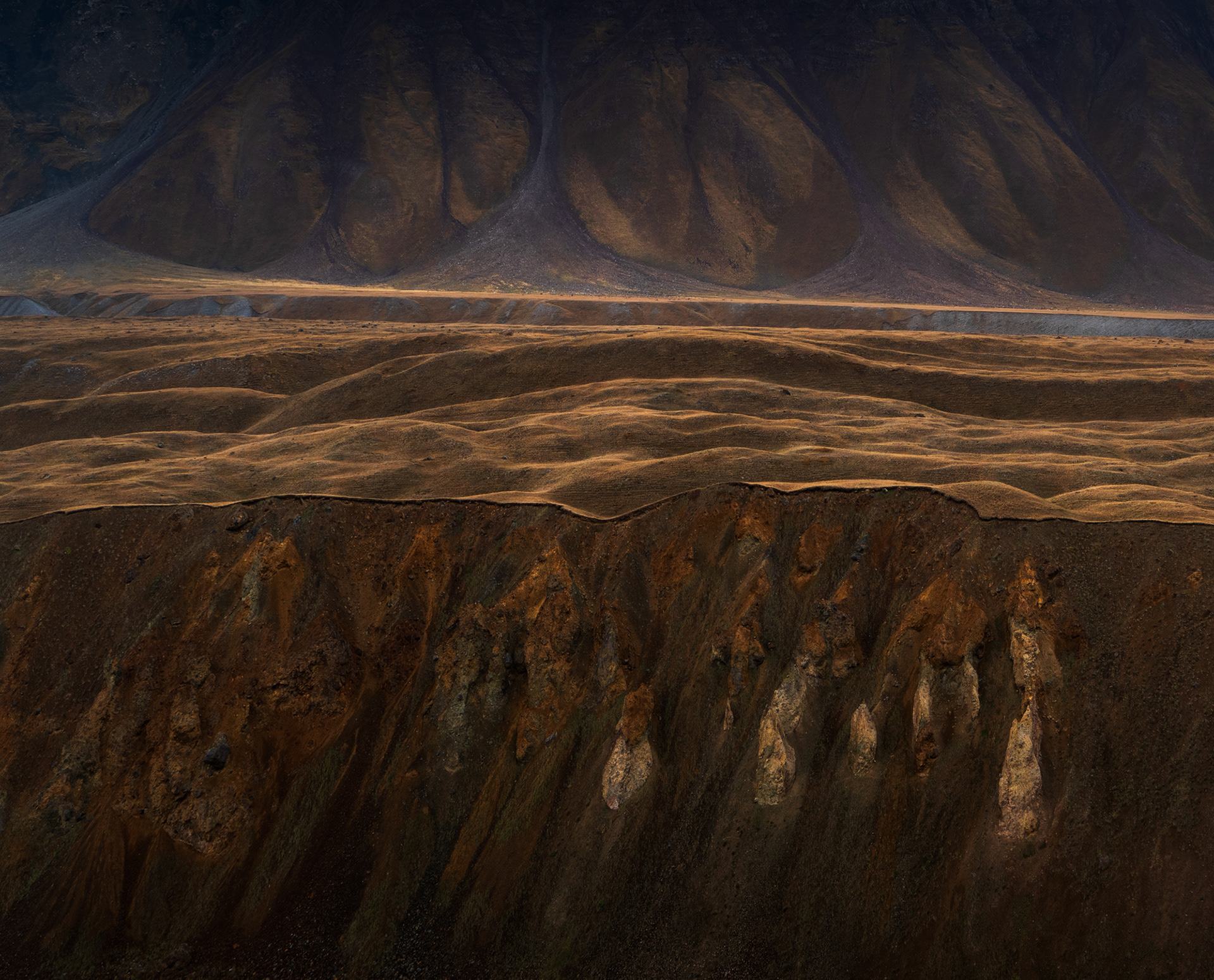
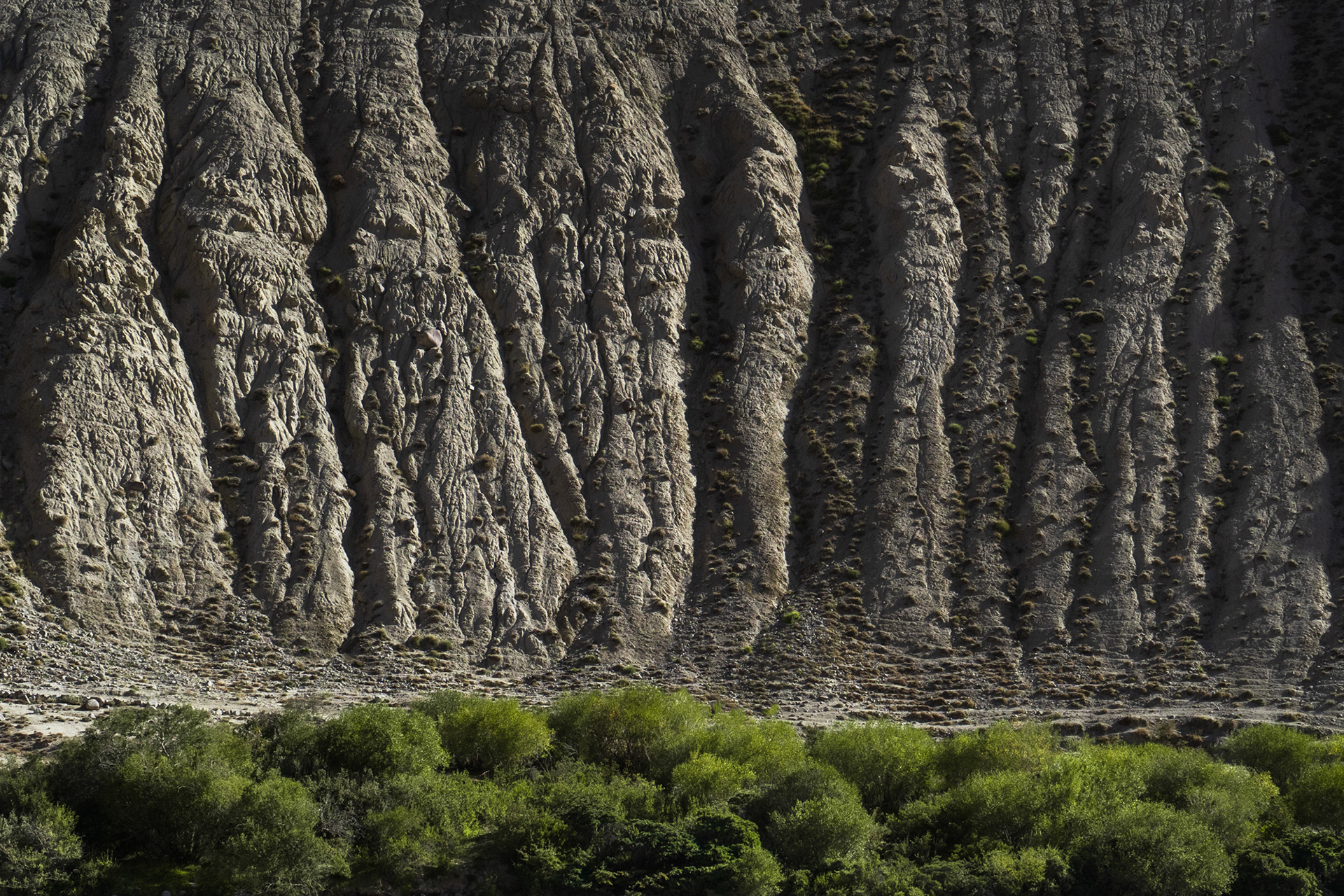
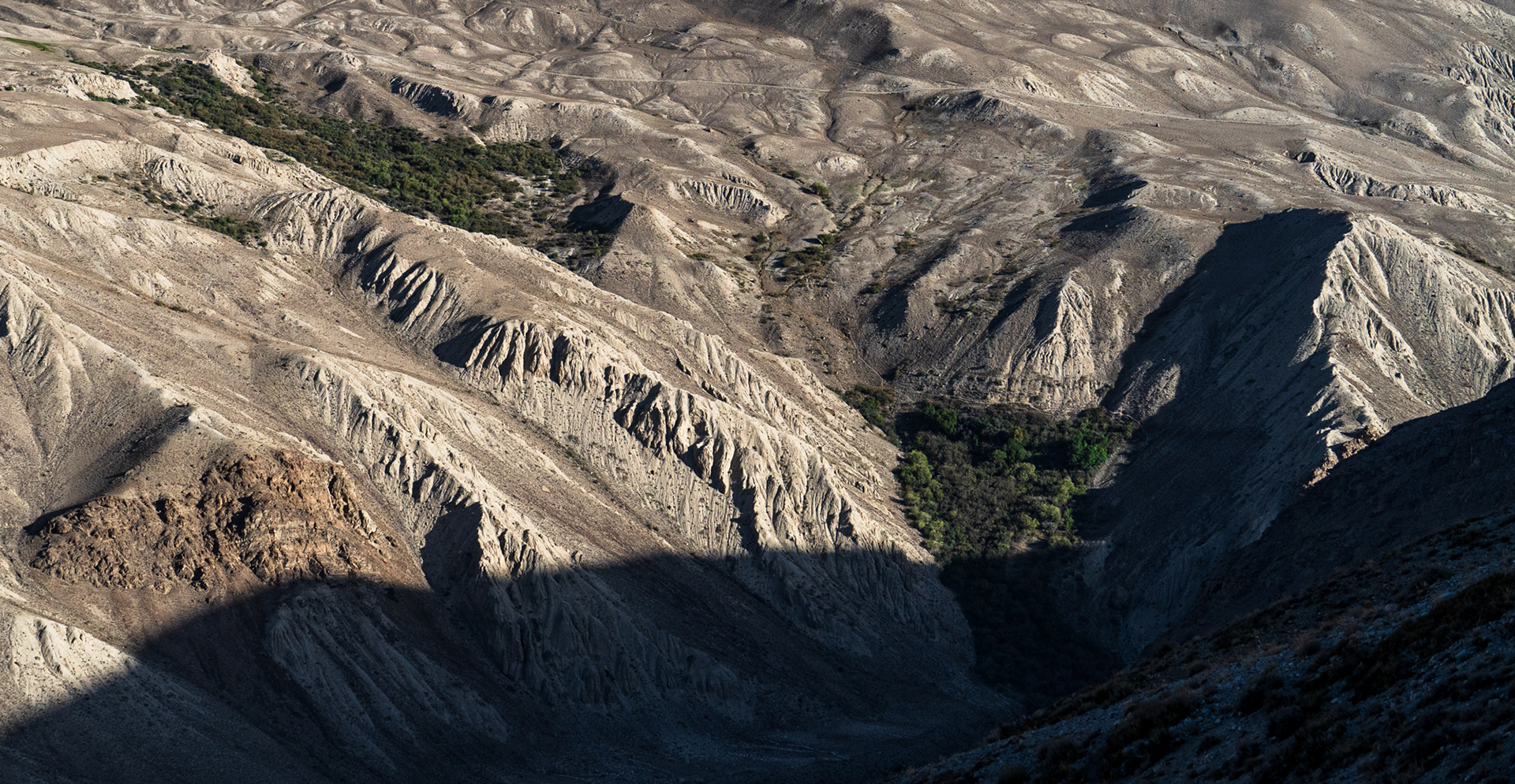
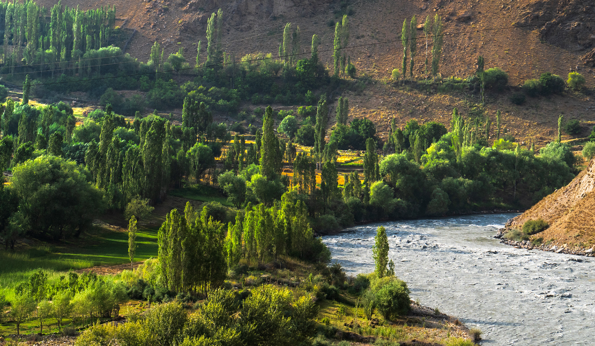
Cliffs above the glacial river.
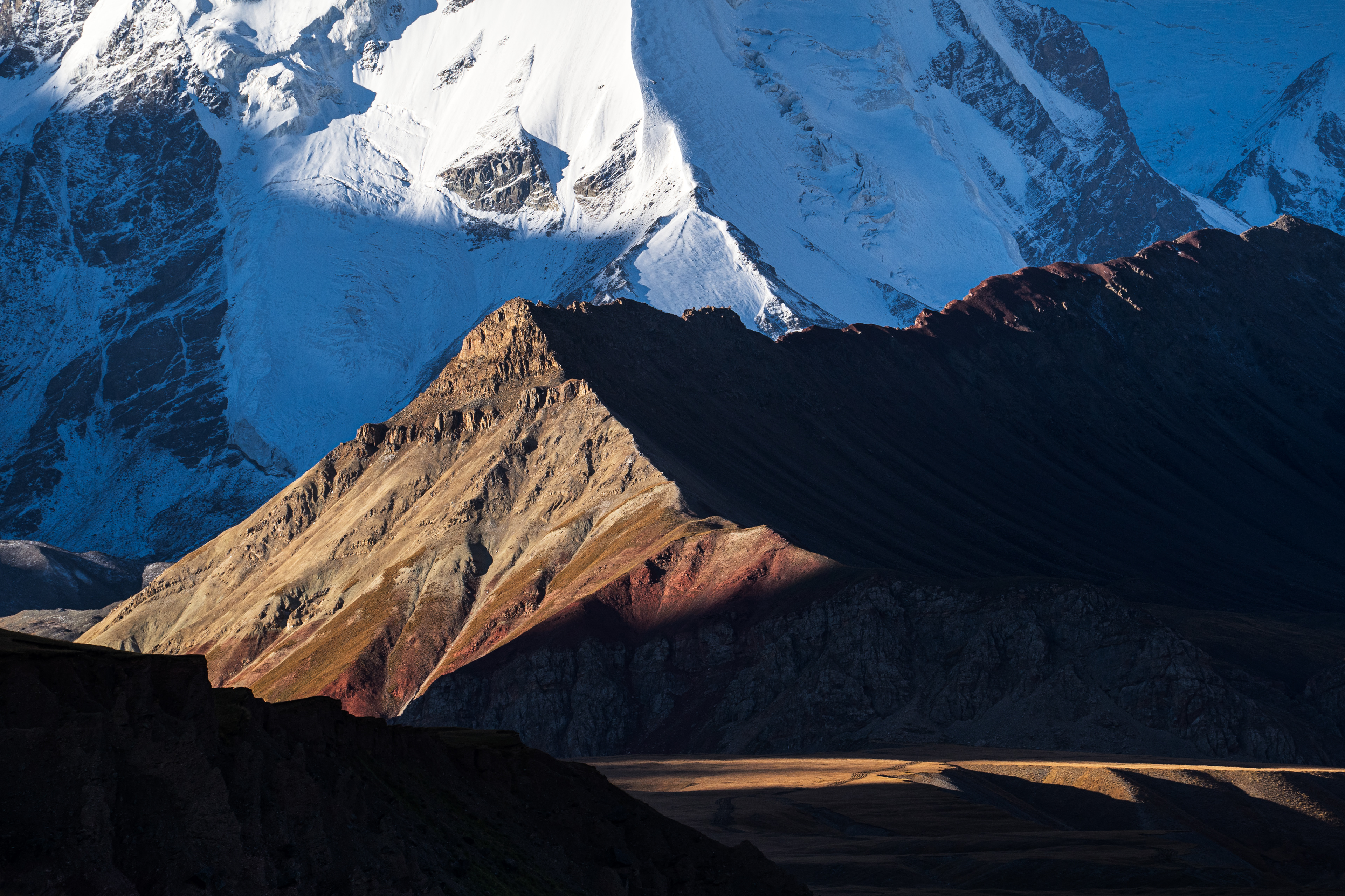
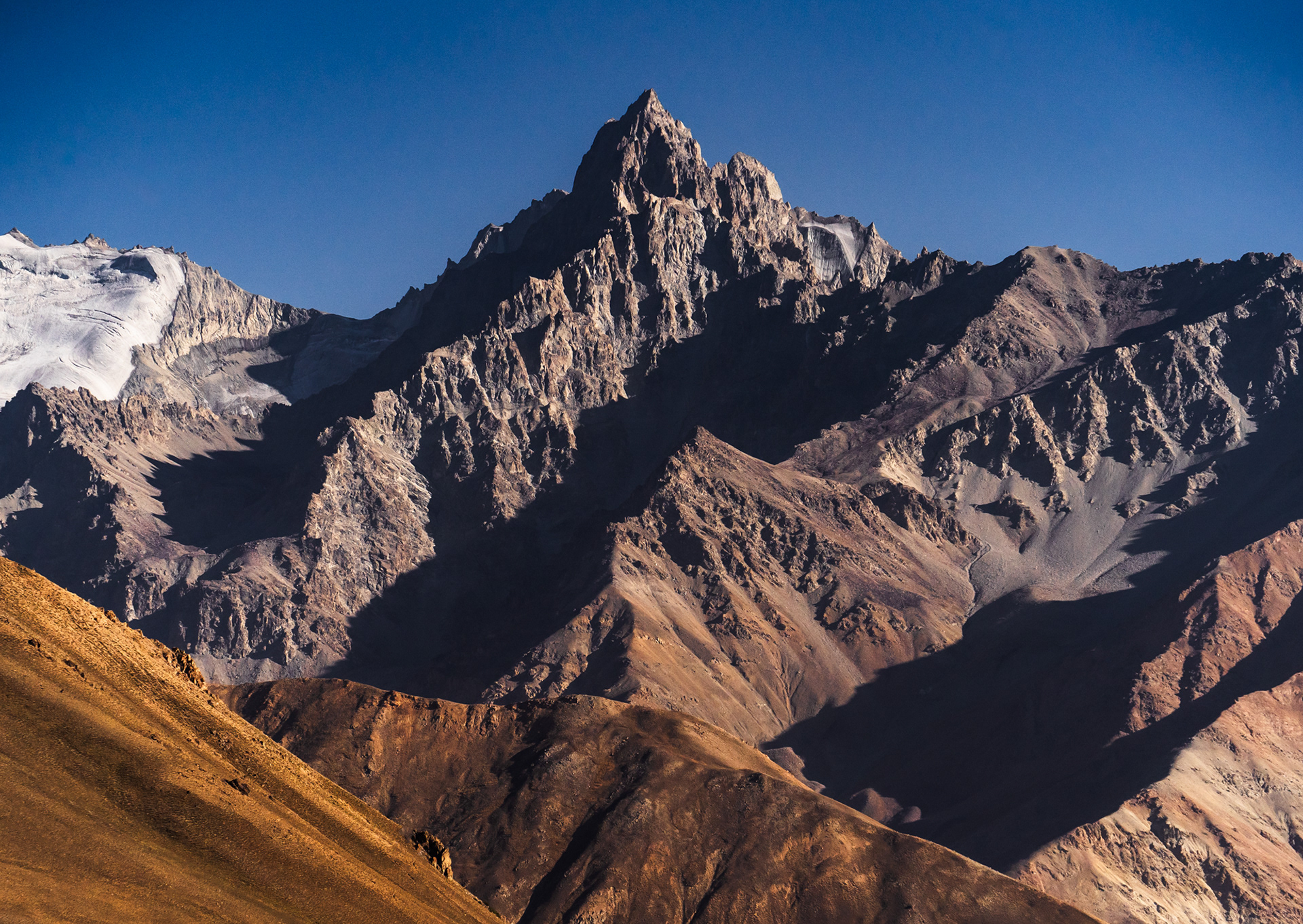
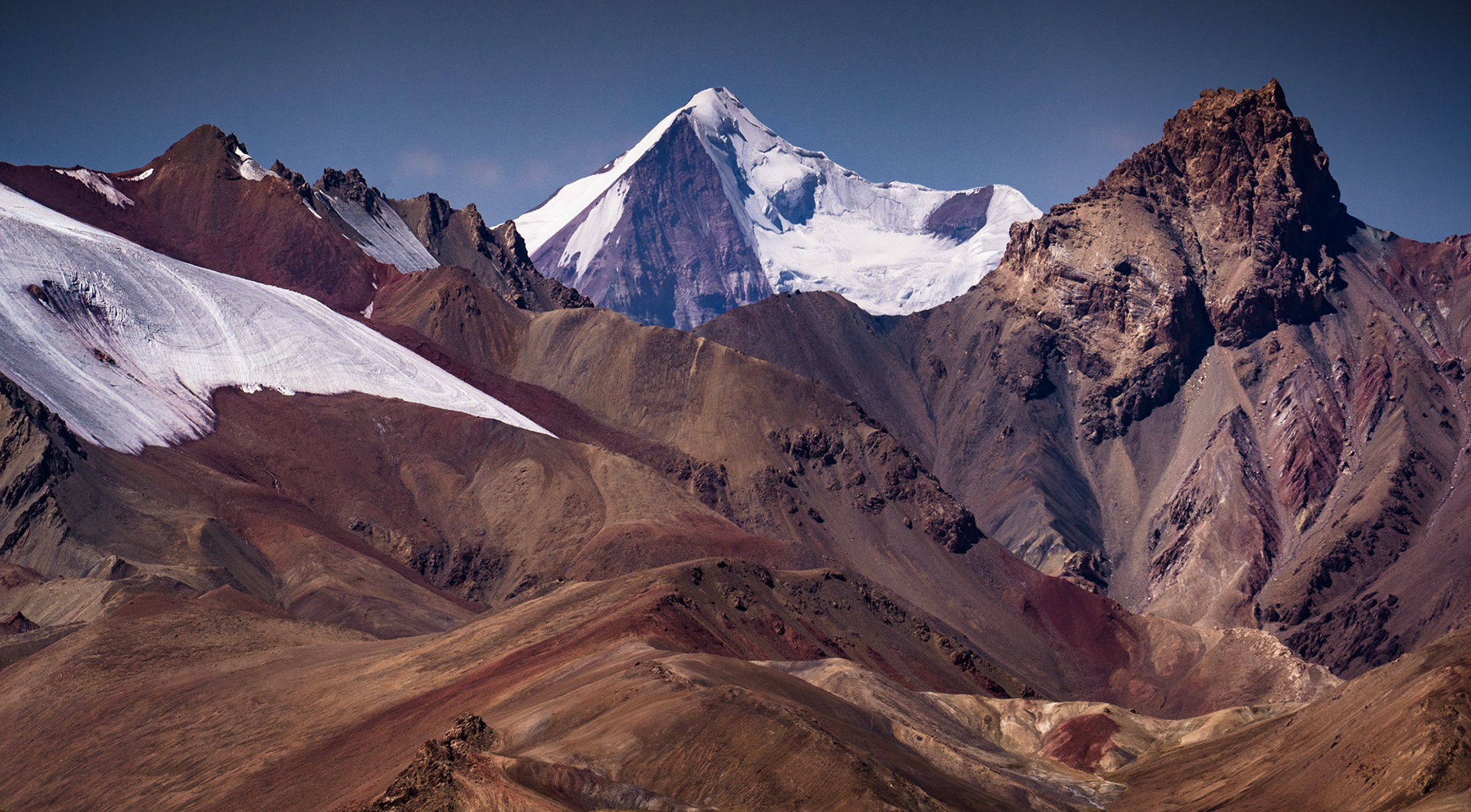
Lower faces of Lenin Peak, Traveller's Pass is just to the right of this scene.
Glaciated face the mountain Peak Lenin and Alay Valley, Kyrgyzstan

Lenin Peak, 7,134m, Lower North Face.

Peak Lenin emerging from clouds, Alay Valley, Kyrgyzstan

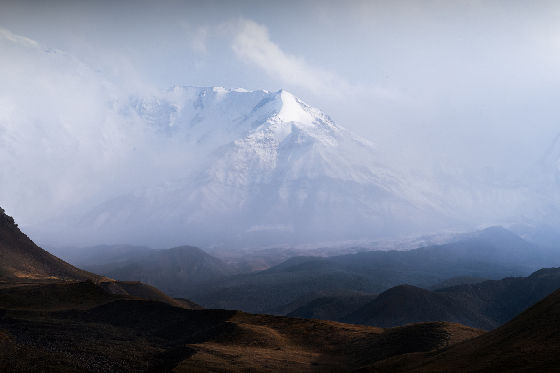
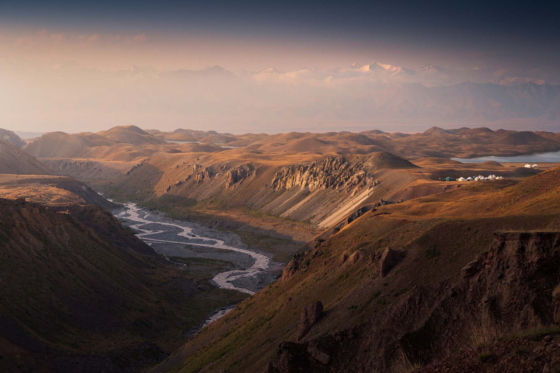
As we began our hike back towards the Yurt Camp, the stormy clouds began to roll in again.

We carried on into Tajikistan, crossing 4,000m above sea level shortly after leaving Kyrgyzstan, and upon crossing the border, we encountered a truly lunar landscape, which was swiftly replaced by a kaleidoscope of colours, and textures. The M41 took us past Lake Karakul, Murghob - the high Pamir's largest town, and hundreds of kilometres of desolate, empty lands.
Colourful mountains of the Pamir mountains upon entering Tajikistan.

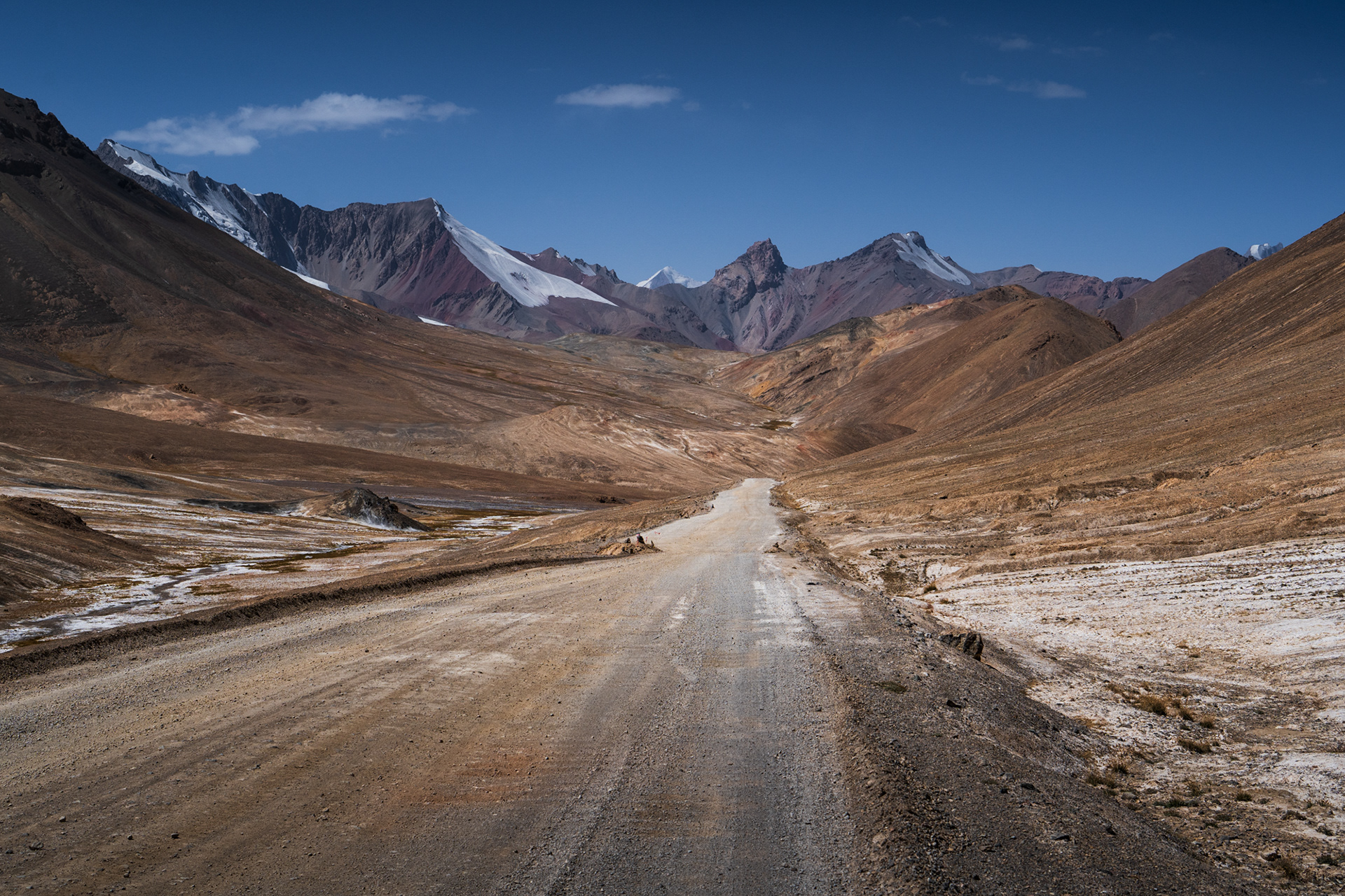
Having climbed to more than 4,000m and officially entered Tajikistan, in the Gorno-Badakhshan Autonomous Region (GBAO), we began our drive towards Lake Karakul. The kaleidoscopic landscape ranged from soft valleys to jagged peaks and glaciers on the North faces.

Dry, parched mountains of different colours in Tajikistan

Looking East, towards China, one sees these colourful hills, more than 4,500m high.

A grey, lifeless landscape visible when driving along the Pamir Highway in Tajikistan

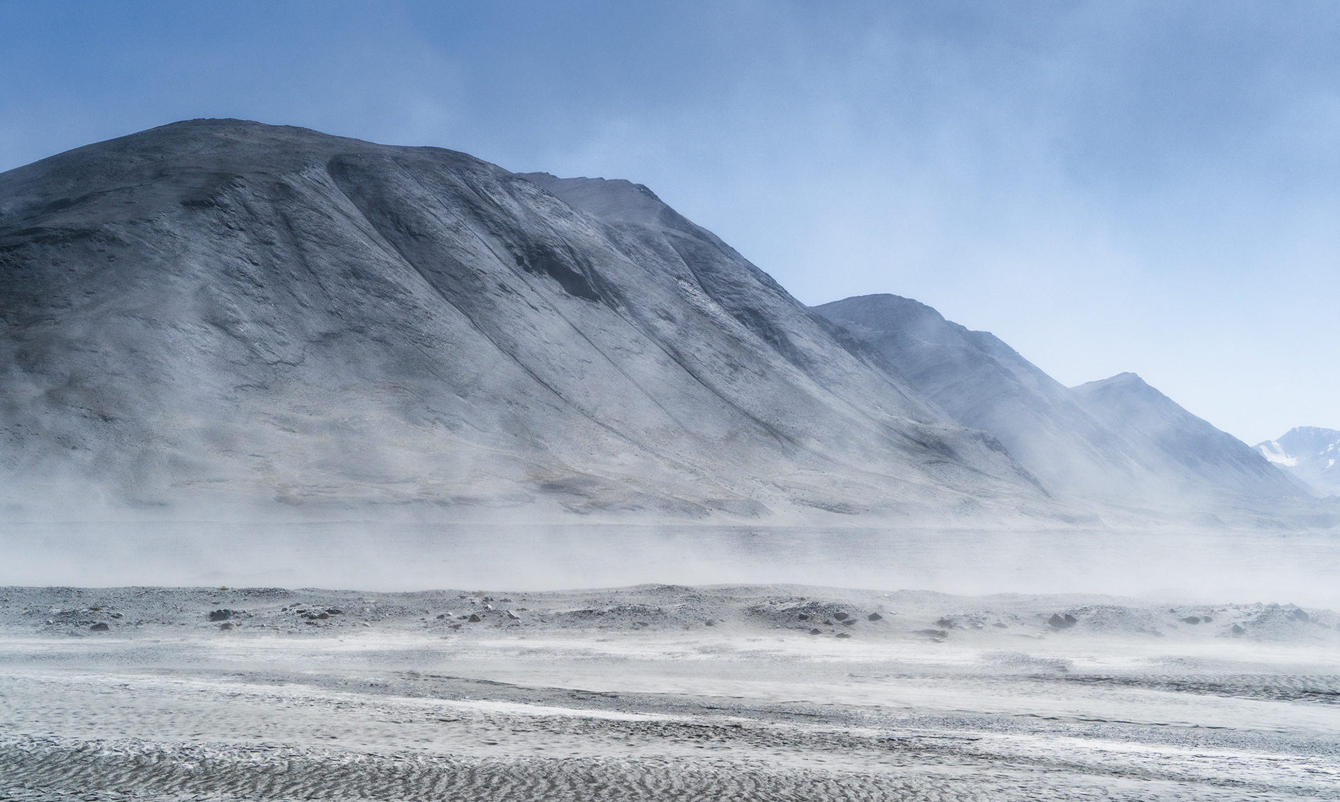
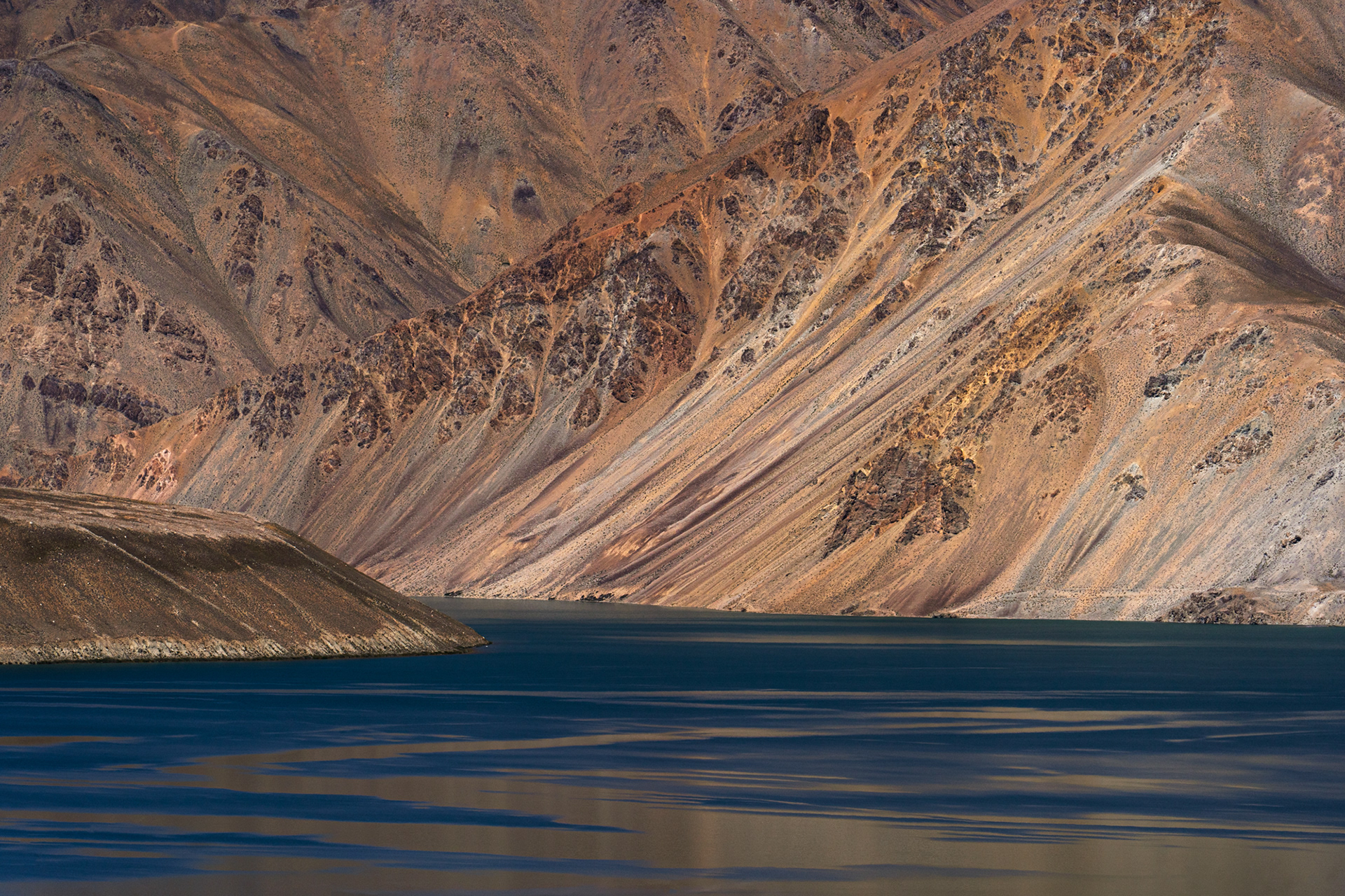
Driving a bit further, the landscape briefly turns entirely lunar. Grey, dusty, lifeless.

Colourful grasses and mountains in Pamir on a sunny day, in Tajik Pamir.

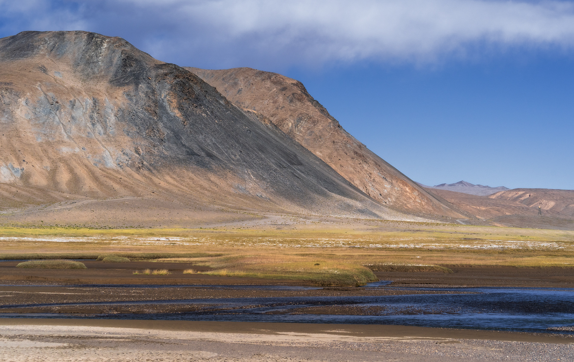
Further yet, colours reappear, as does the existence of water.

A snowy glaciated mountain called Muztagh Ata catches the last rays of sun.

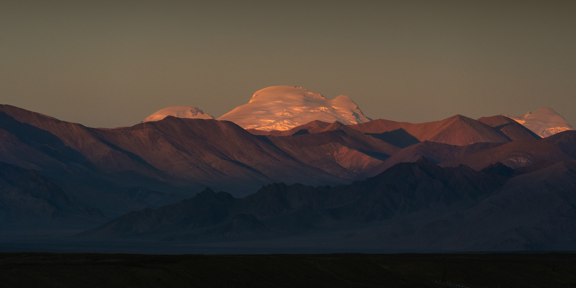
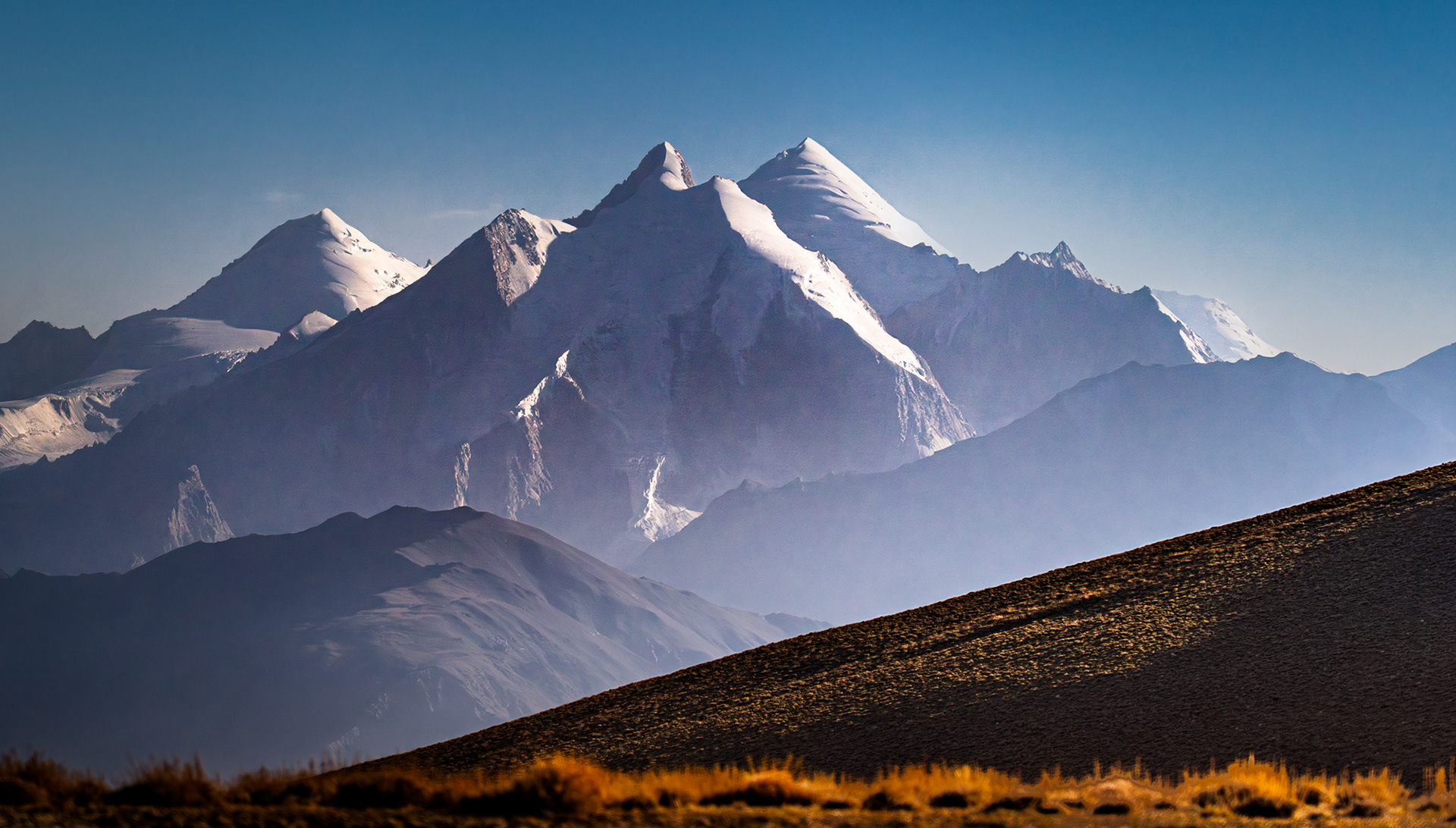
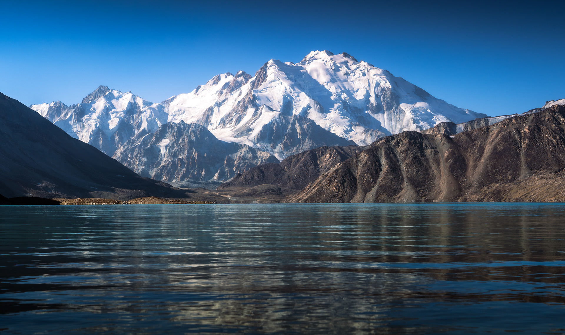
We arrived in Murghob, the local capital, a town of just over 4,000 people, a few hours later. As the sun was setting, we caught an unexpected glimpse of Muztagh Ata, a 7,546m ice giant in China's Xinjiang, more than 70 kilometres away.

A photo of hazy layered mountains in bright sun.

The next morning, we set out for Shorbulak Observatory. an abandoned Soviet station hidden in the Great Pamir, a couple of hour's detour from the M41. 

 A photo of a very large, glaciated mountain in Western China that rises high above the Tajik landscape

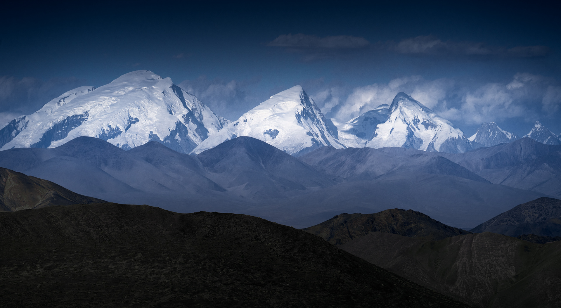
Driving towards the abandoned Shorbulak Observatory in the depths of the High Pamir, we again caught a glimpse of something spectacular: Muztagh Ata, 'Icy Father', a 7,546m giant rising almost four kilometres above Xinjiang - more than 90 kilometres away from where we were standing. Together with the neighbouring Kongur Tagh, these two mountains are considered the northern terminus of the massive mountain chain consisting of the Himalayas, the Karakoram, the Hindu Kush, and the Pamir.

Jagged mountains in a hazy light in Tajikistan

The vast landscape of the Greater Pamir, as seen from Shorbulak Observatory.

A sharp, orange mountain rises from a flat valley in Tajikistan under a clear sky.

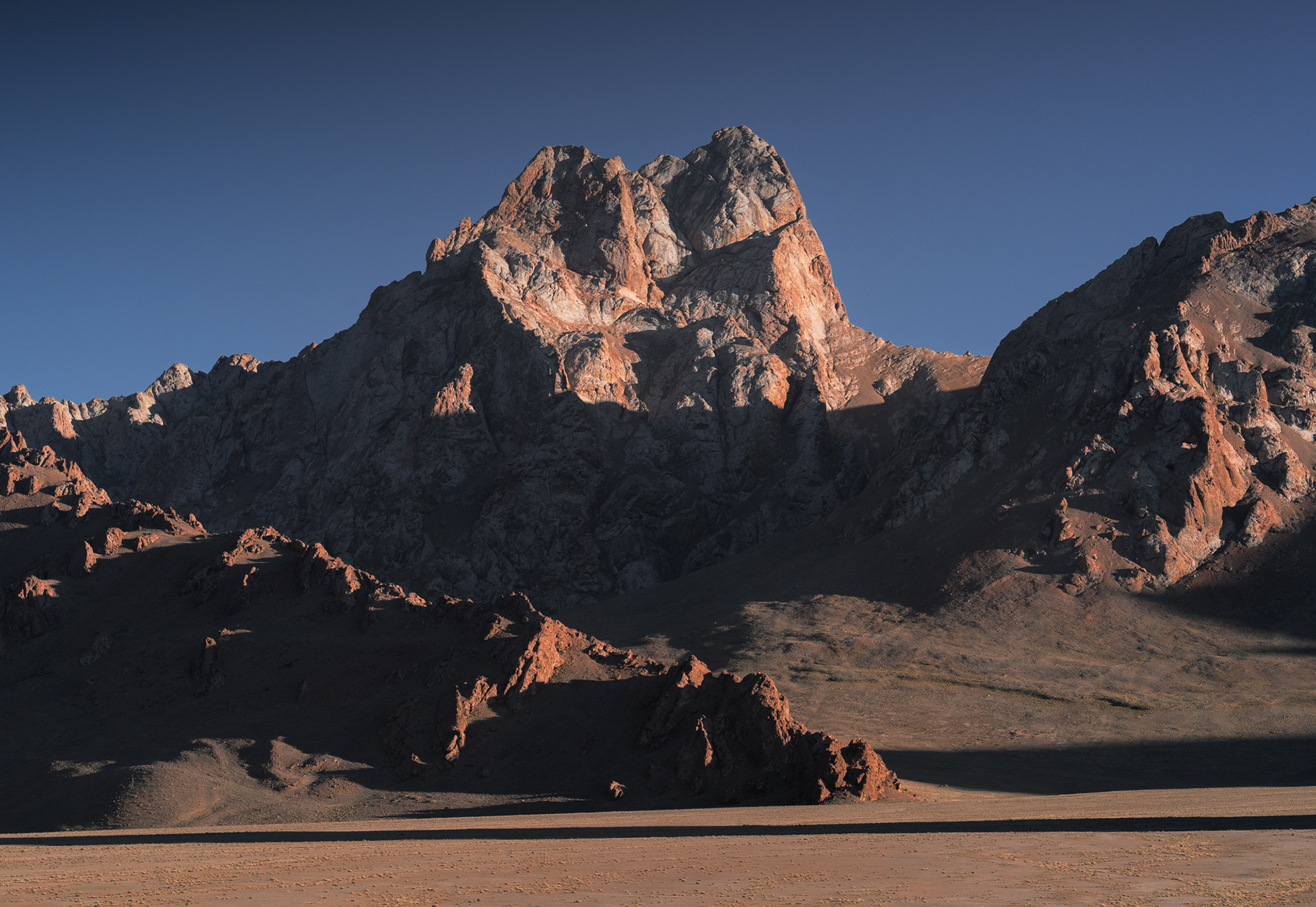
Jagged peaks rise from the flat valley floor. A typical condition of the landscape in this part of Eastern Tajikistan.

A photo of a still lake under some very textured mountains in Tajikistan.

A short detour to Yashilkul Lake.

Turning South into the Wakhan Valley, we would spend the next two days driving just a few hundred metres from Afghanistan. Its parched badlands gave way to increasingly rugged and jagged ridges, terminating in towering, snowcapped peaks rising to more than 6,500m. 
A rugged road through a barren landscape leading towards the Wakhan Valley with snowcapped peaks of Afghanistan in the background.

Turning off the main Pamir Highway, the M41, we turned South towards the Wakhan Valley, towards Afghanistan, whose snowcapped peaks are visible in the photo.

Highly textured muddy hills.

Mere dozens of metres away, the textured lands of Afghanistan rise above the Panj River.

A rugged landscape of grey coloured hills with some patches of green oases.

The rugged badlands of Afghanistan.

A very jagged peak rises above a harsh rocky landscape in Afghanistan.

Unnamed peaks such as this one rise to 5,300m.

A glaciated mountain in Afghanistan.

Koh-E Qala Panja, 6,328m, Afghanistan

A jagged mountain with a knife-sharp ridge on the border of Afghanistan and Pakistan.

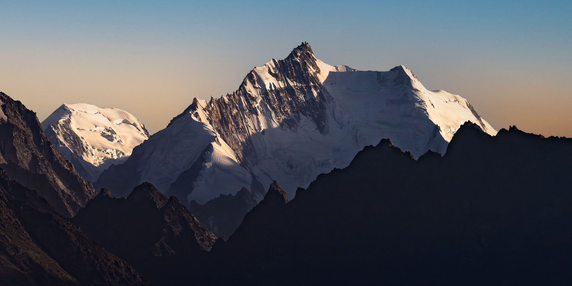
Koh-E Sedara, 6,150m, Afghanistan

A panoramic photo of 6,000+ meter mountains in Afghanistan as seen from Tajikistan during an evening sunset.

Panorama of the Pamir, Wakhi, and Hindu Kush mountains. Shot from Tajikistan.

A lush village in Afghanistan with some stone huts.

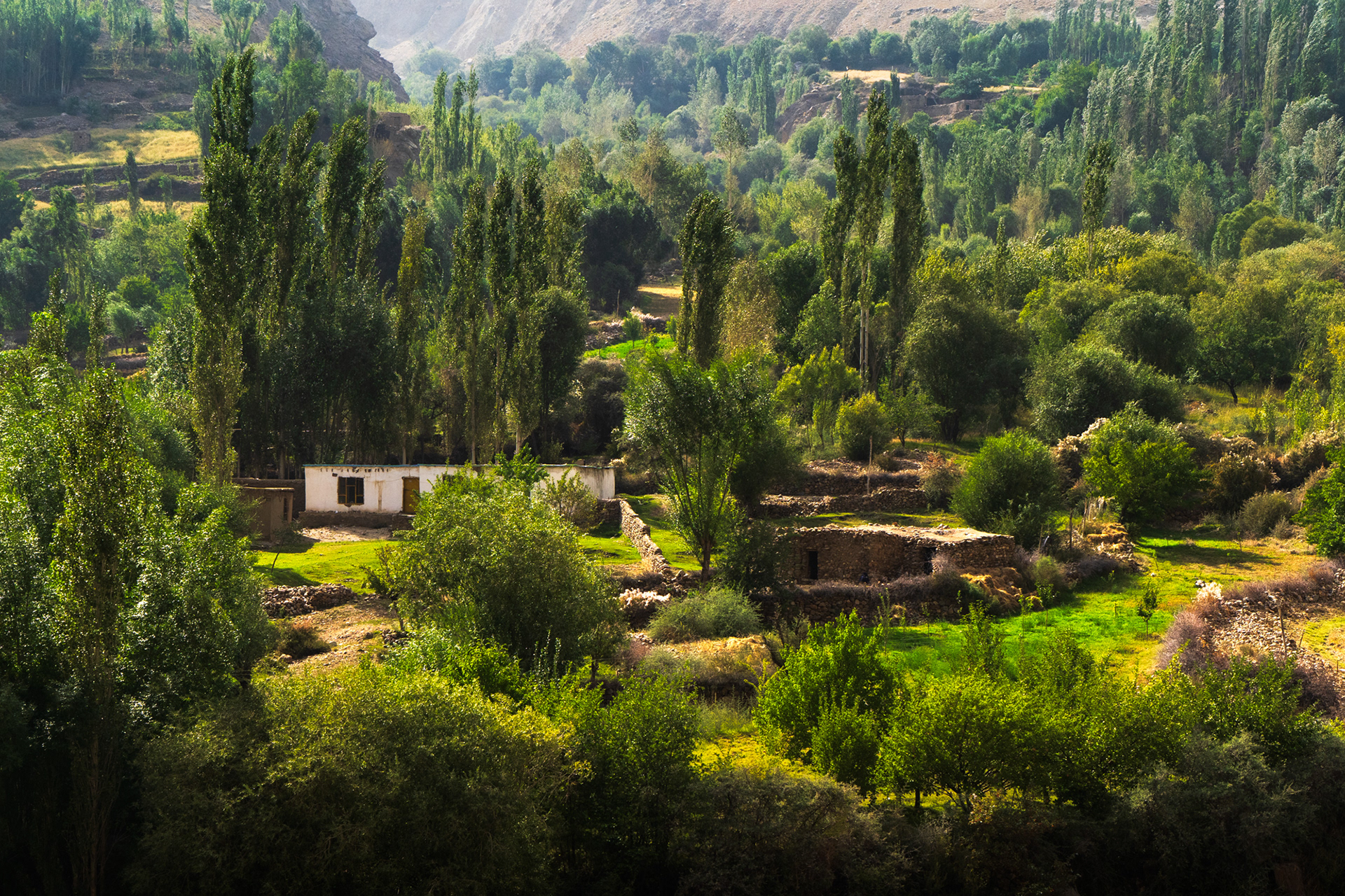
Lush villages just above the Panj river on the Afghan side of the Wakhan Valley.

Tall, lush skinny trees rise above the Panj River in Afghanistan.

Afghanistan on the left, Tajikistan on the right.

After a much-needed break in Khorog - the official capital of the Pamir, home to around 30,000 people, we drove to Bachor, a small farming village at 3,300m, and began our 5-day trek through the harsh mountains to Tsaxinkul and Zaroshkul Lakes, lying at 4,300m and 4,500m, respectively.
A dramatic peak rises above a sun-illuminated lake called Tsaxinkul in Tajikistan.

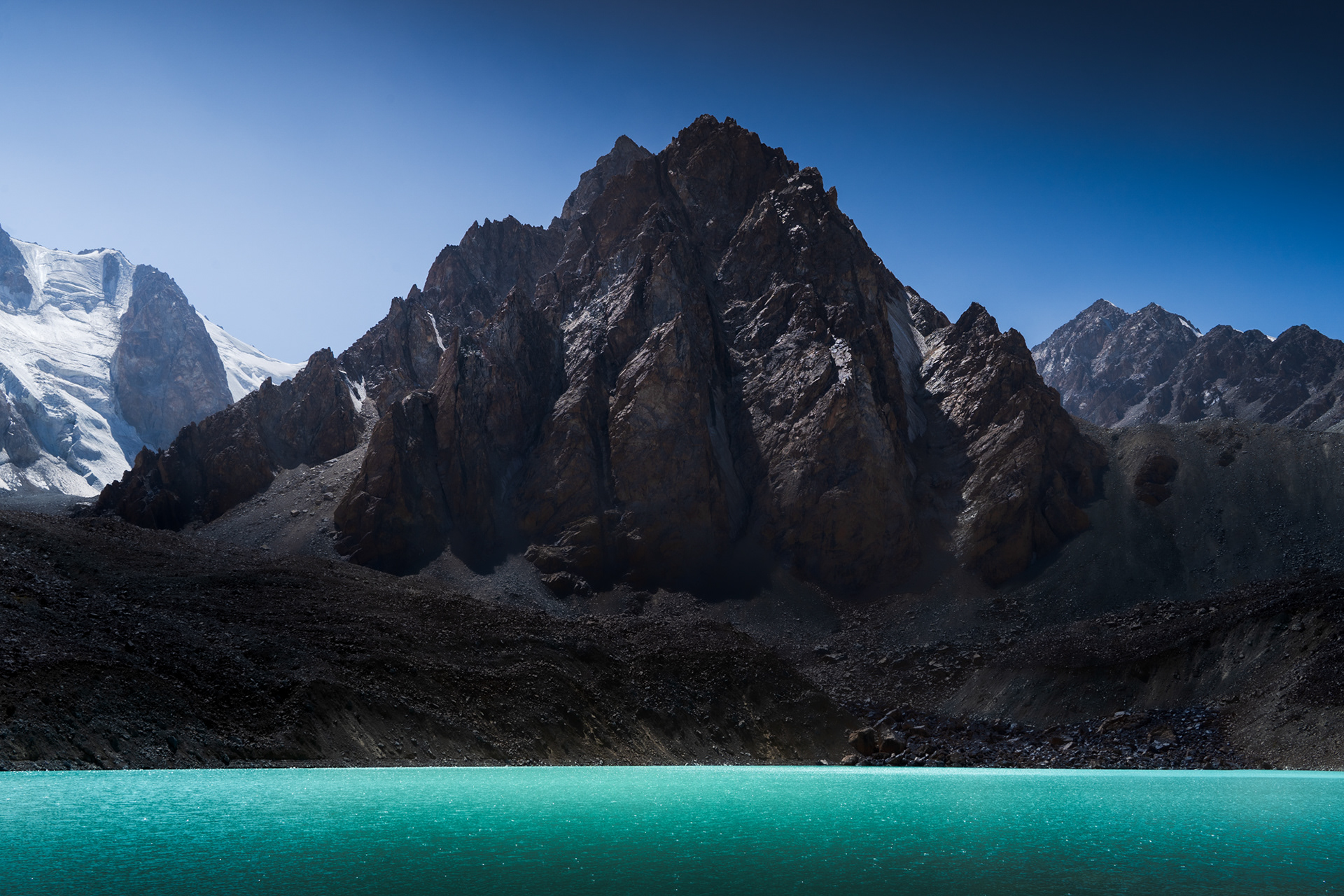
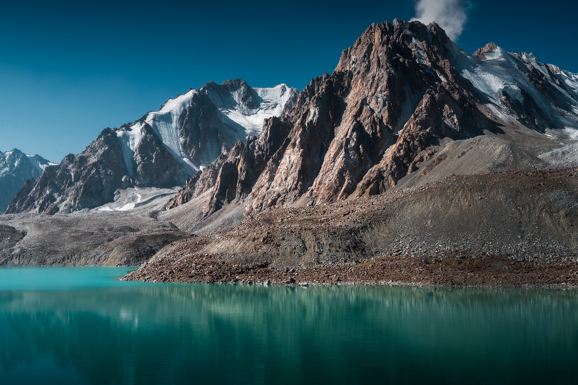
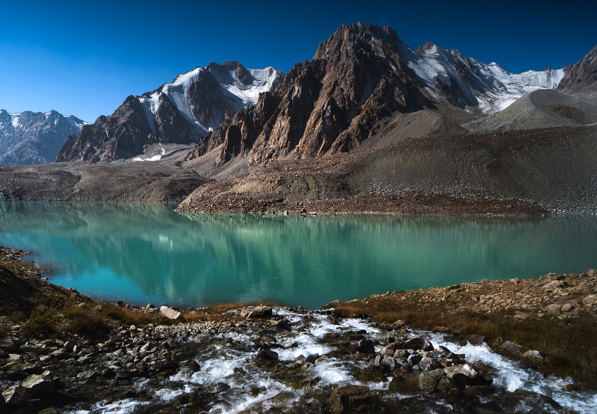
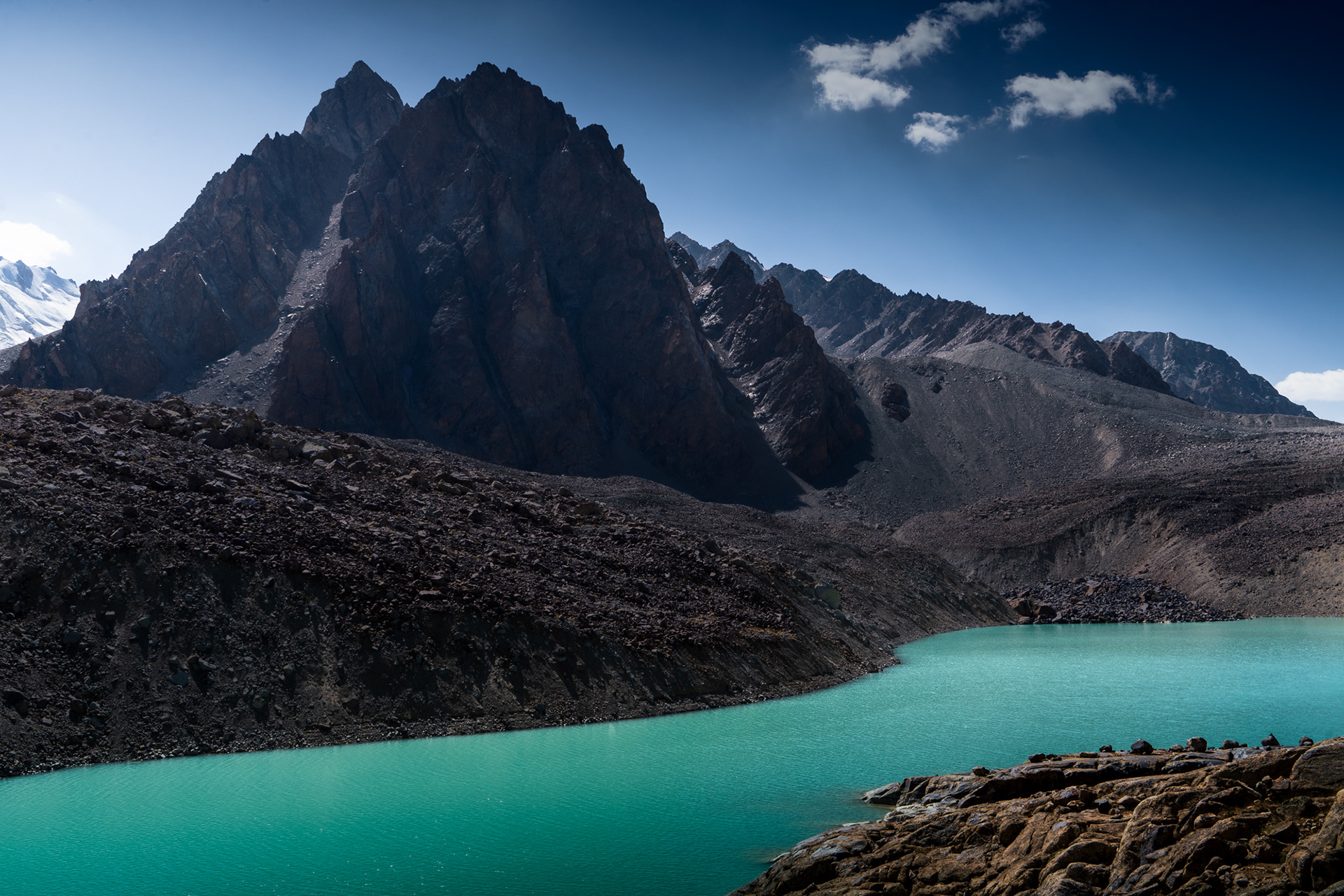
Tsaxinkul Lake, 4,300m. The dramatic peaks above rise to almost 5,000m.

A sunrise mountain is reflected in a mirror-like Tsaxinkul lake.

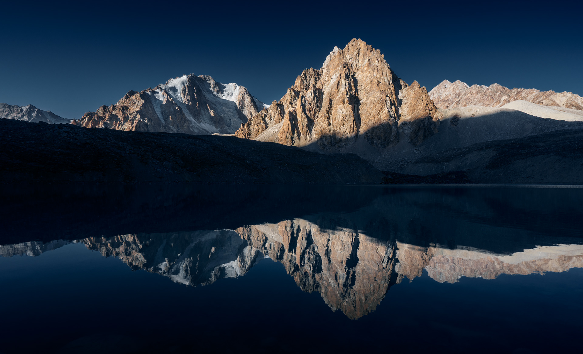
Morning reflections at Tsaxinkul Lake.

A dramatic jagged peak rises above Tsaxinkul Lake.

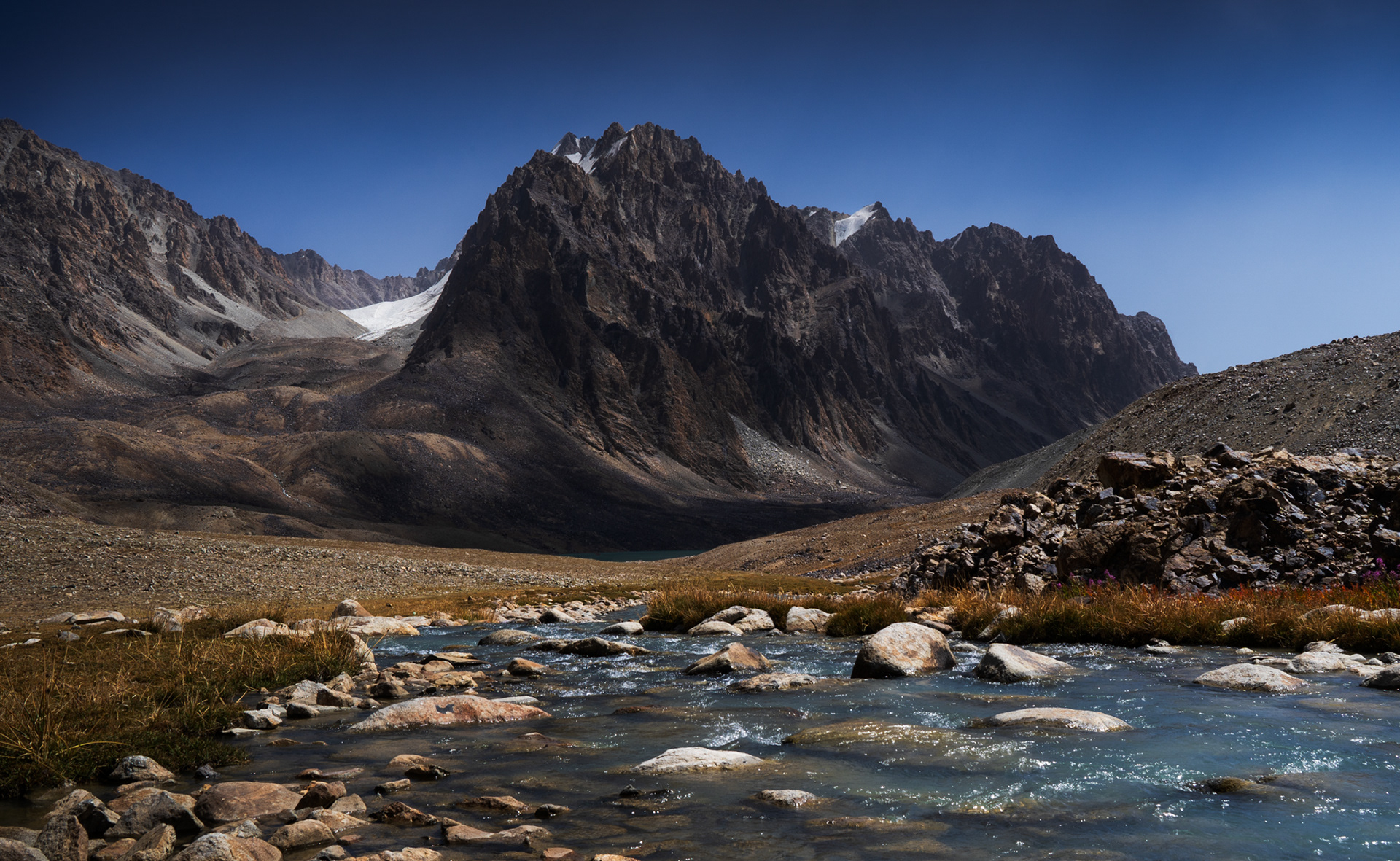
Setting off towards Zaroshkul Lake, we spend an hour scrambling along the shores of Tsaxinkul.

A large glaciated mountain rises above the emerald Zaroshkul Lake.

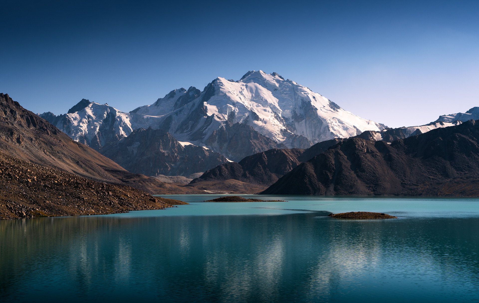
Several rather gruelling hours later, we made it to Zaroshkul Lake, lying at 4,500m, just in time for the sunset.

Sunset hits the jagged peaks of a mountain.

The last rays of light hitting the jagged peaks of the Shakhdara Range.

Sunset illuminates a glaciated peak in Zaroshkul Lake, Pamir.

Sunset view from our camp.

A zoom in photo of a glaciated peak.

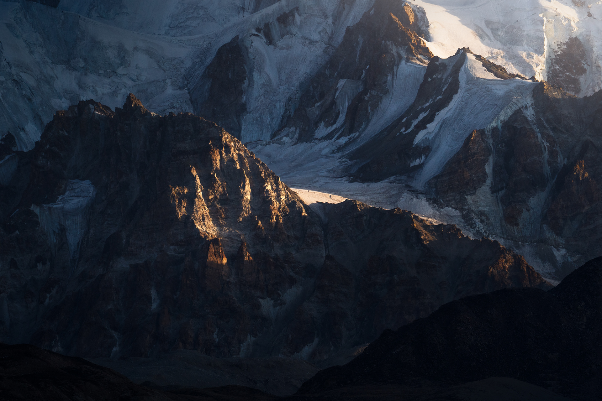
Glaciers of the Shakhdara Range.

Sunrise hits the glaciated mountain above a lake.

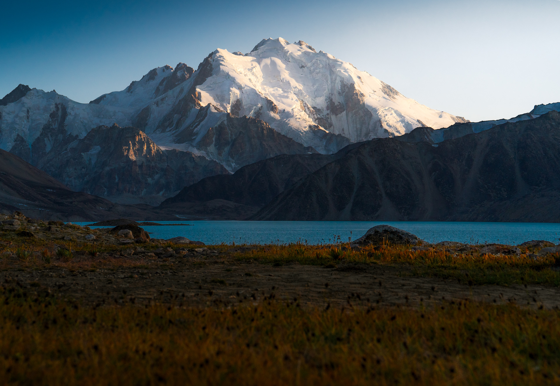
Crisp sunrise the next morning, a soft breeze rippling Zaroshkul Lake.

A landscape with jagged peaks and a river in the foreground.

Descending back towards Bachor, the settlement where we started. Tsaxinkul Lake is just about visible in the centre of the frame, at the base of a 5,000m peak.

A mountain stream flows into the emerald Tsaxinkul Lake with epic peaks rising above it.

Passing by the shores of Tsaxinkul once more.

A jagged peak rises above a calm Tsaxinkul Lake in Tajikistan Pamir Mountains.

Saying goodbye to Tsaxinkul with this dramatic scene.

Our last stop before returning to Kyrgyzstan was to one of the most remote villages in Tajikistan - Rangkul, at 4,000m in the country's far-eastern corner, just a few kilometres away from China's Xinjiang. 
A dusky sky above a grassy landscape with Rangkul Lake on the left and jagged mountain peaks of the Pamir, Tajikistan.

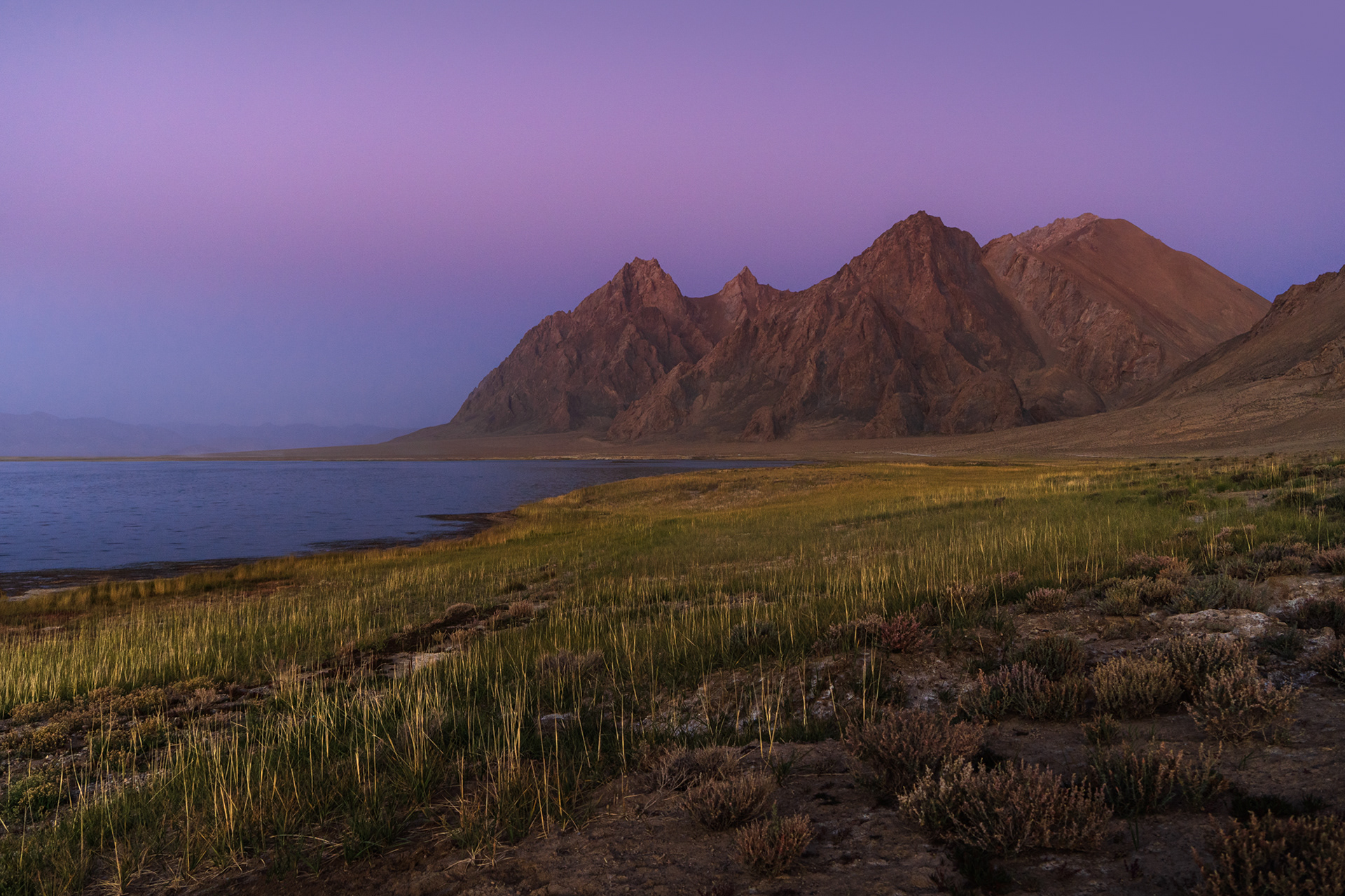
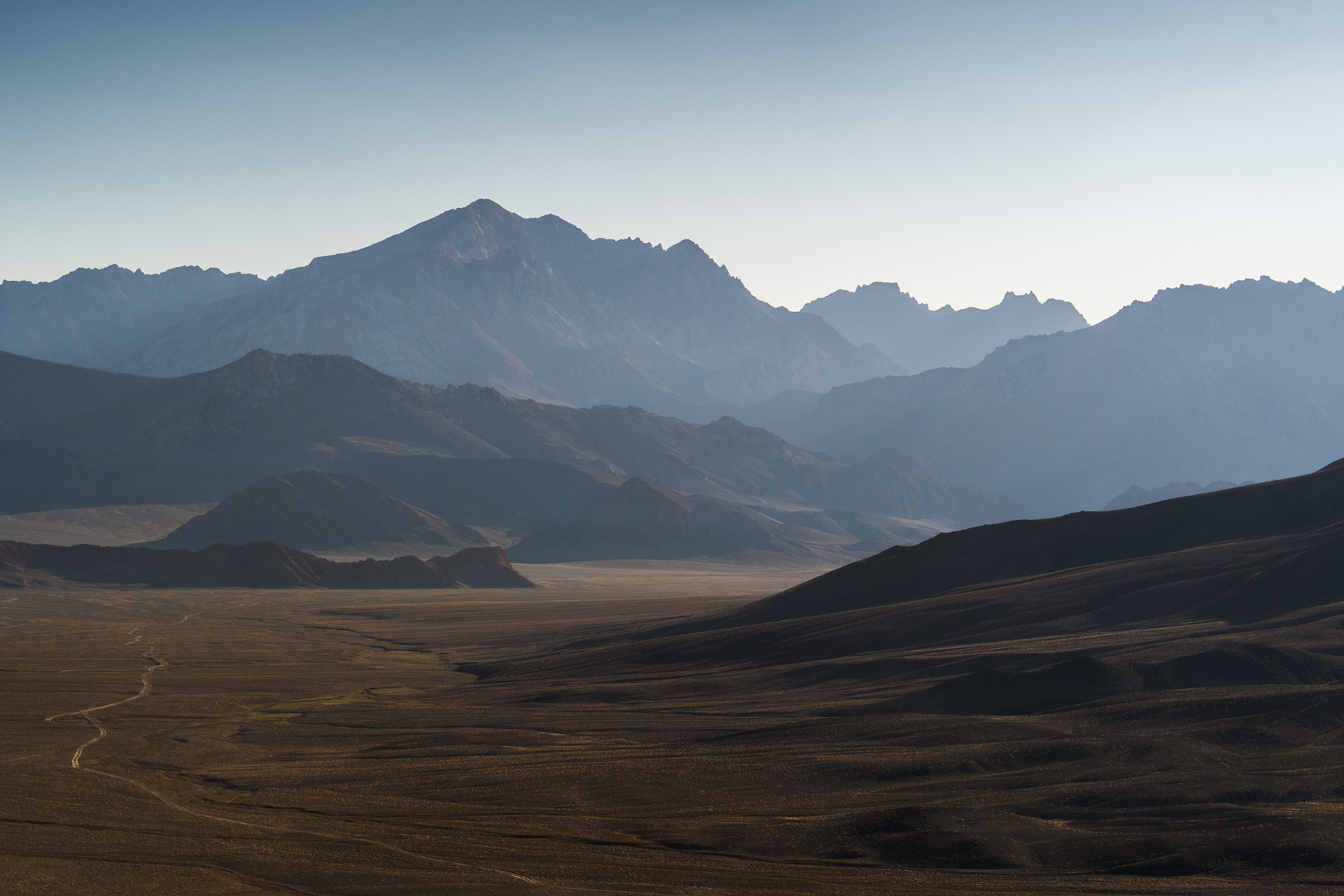
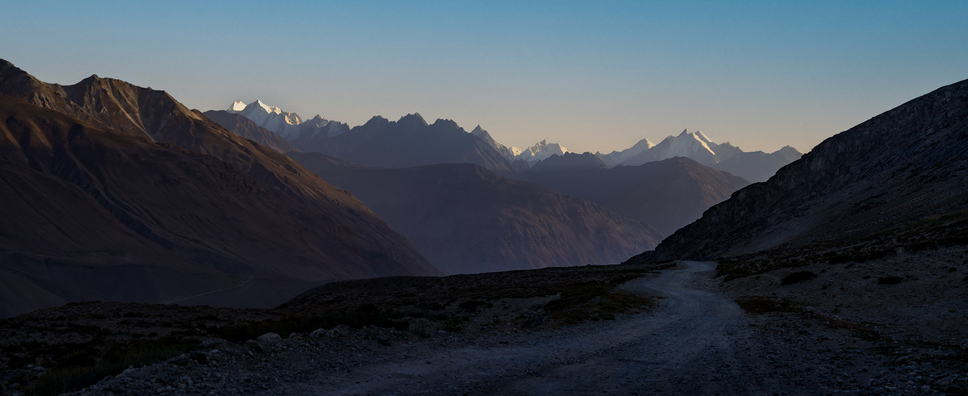
Turning off the M41, we began our two hour drive towards Rangkul. As the sun set and dusk coloured the skies, we caught our first glimpse of Rangkul Lake.

An old car driving on a very rugged road through a colourful landscape and a hazy sky.

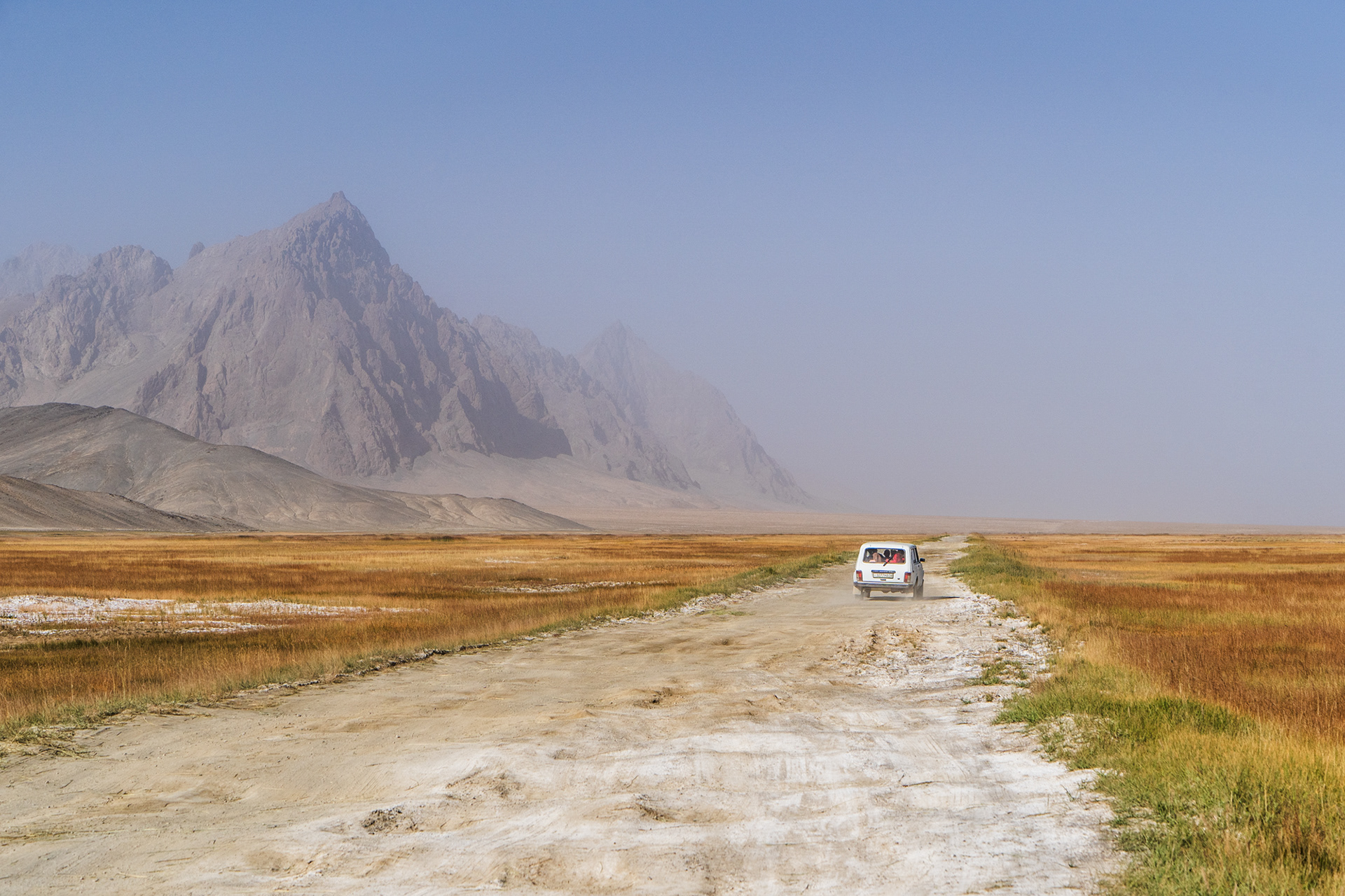
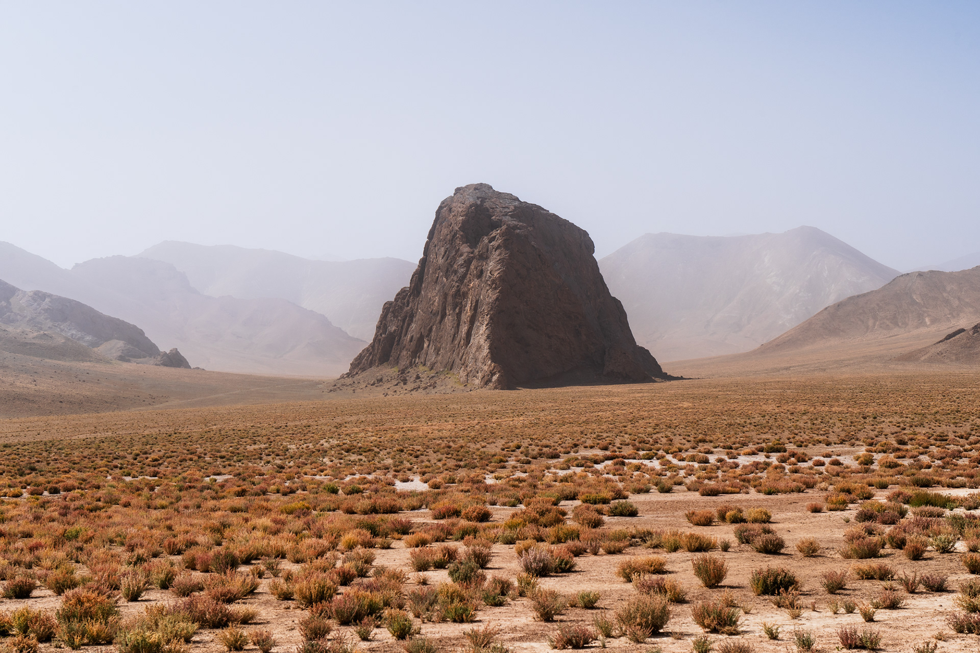
We woke up to a very heavy haze that had rolled in from Xinjiang - even though the border was less than 5 kilometres away, we could not see any part of China. After a slow start, we set out to see what we could, as we began the drive back towards the M41. For a little while we trailed behind this Soviet-Era Lada, which was handling the bumpy mud road surprisingly well.

Looking South into the Great Pamir.
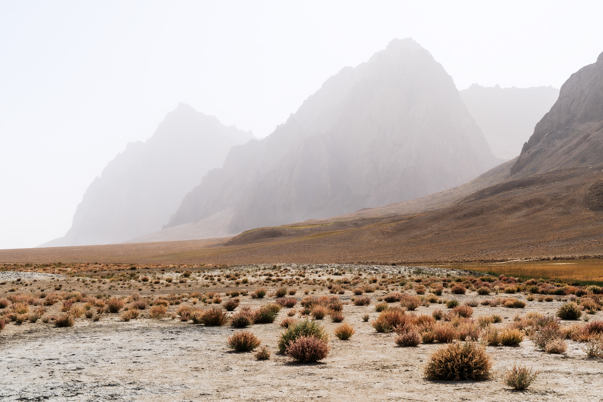
Salt marshes surrounding Rangkul Lake
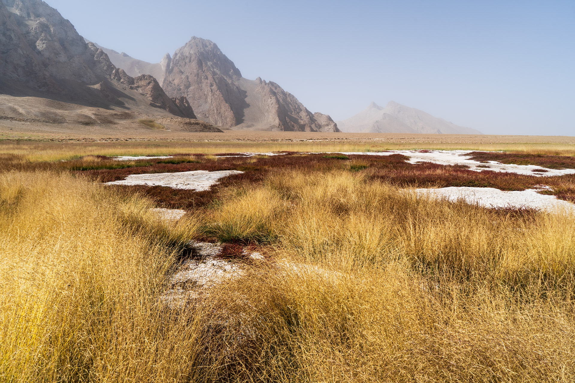
Salt Marshes and Grasses near the edge of the lake.
A colourful grassy landscape with jagged peaks and a lake in a hazy sky.

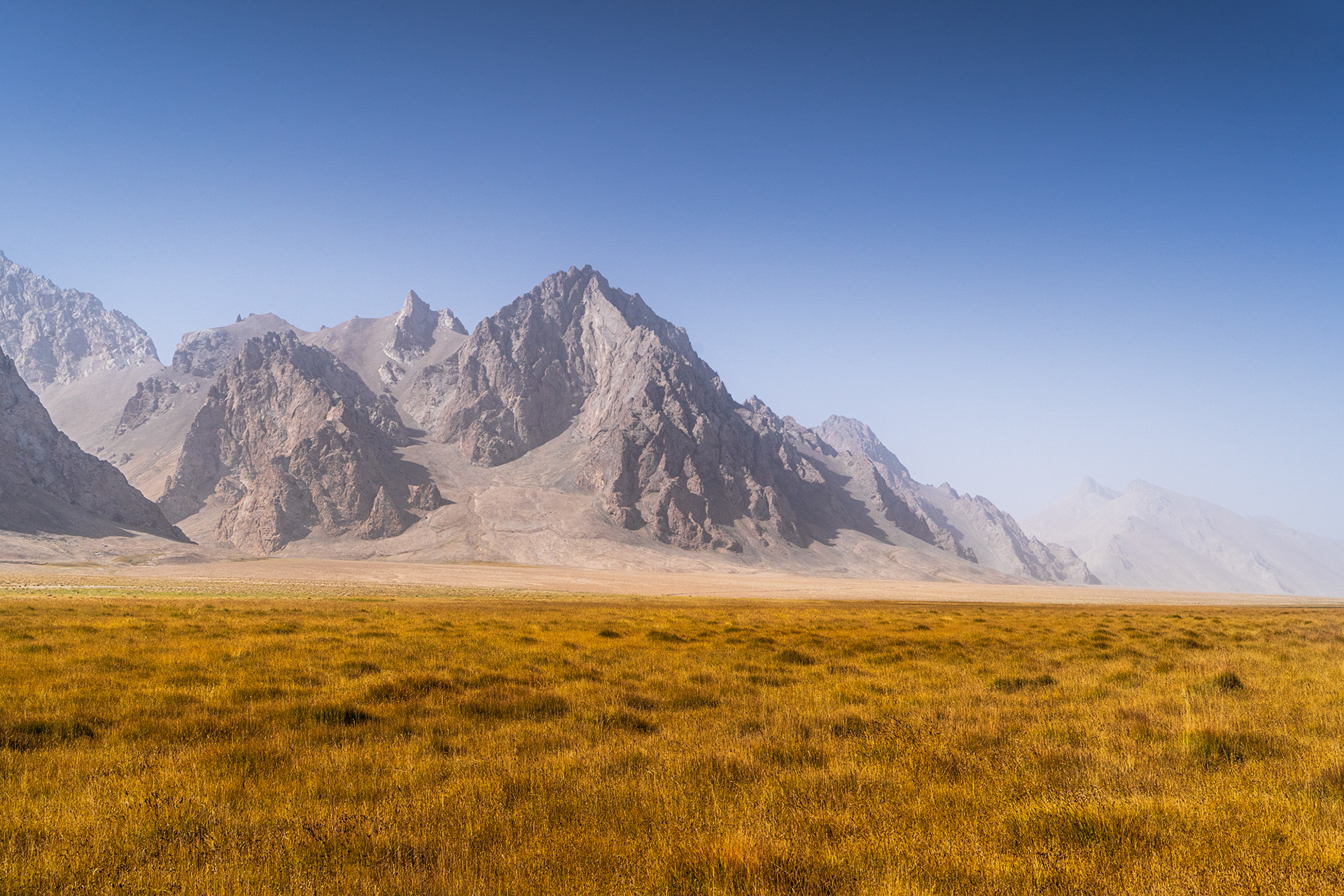
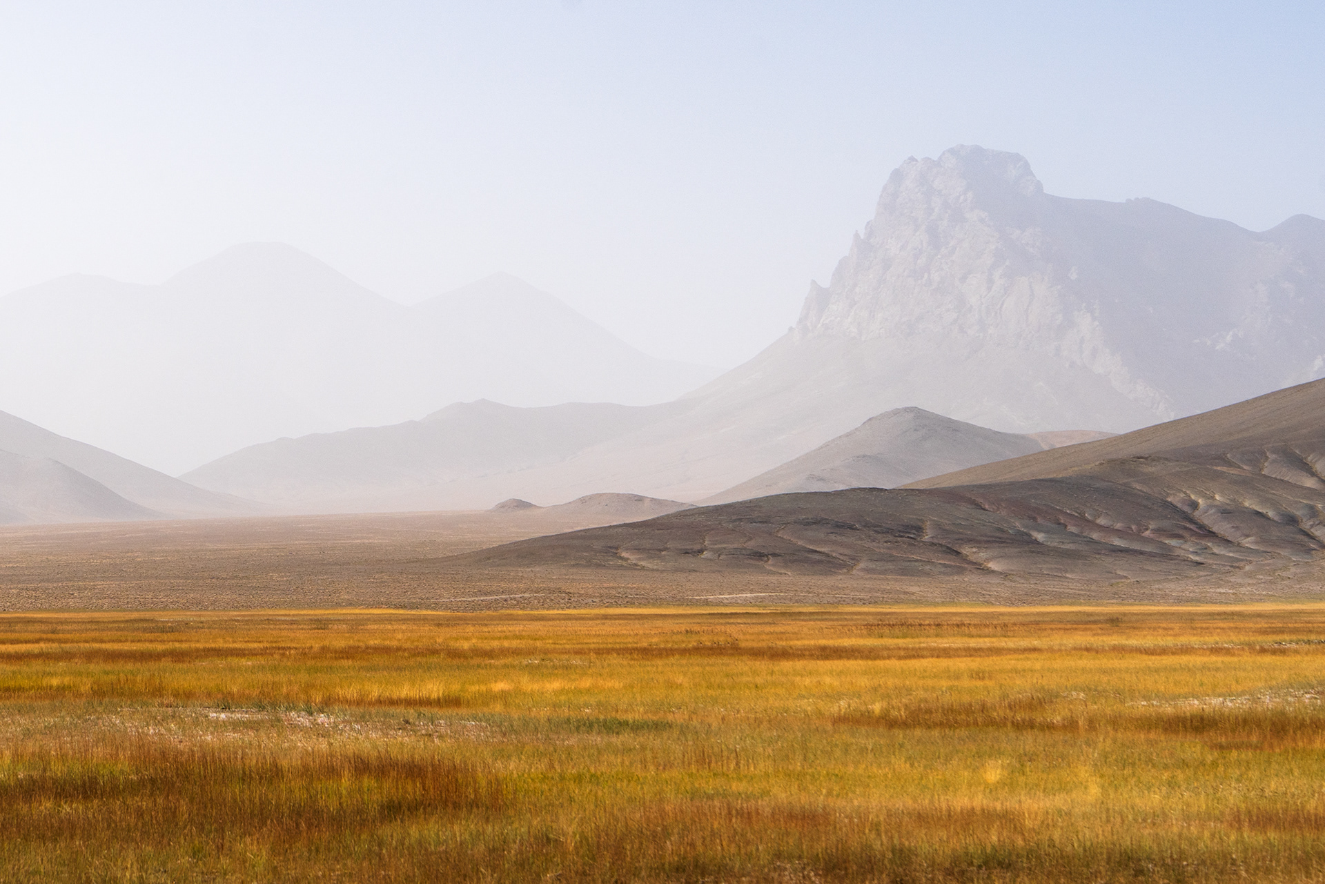
Dry, nutrient rich grasslands surrounding Shorkul and Rangkul Lakes. A haven for migratory birds from afar as the Himalayas.
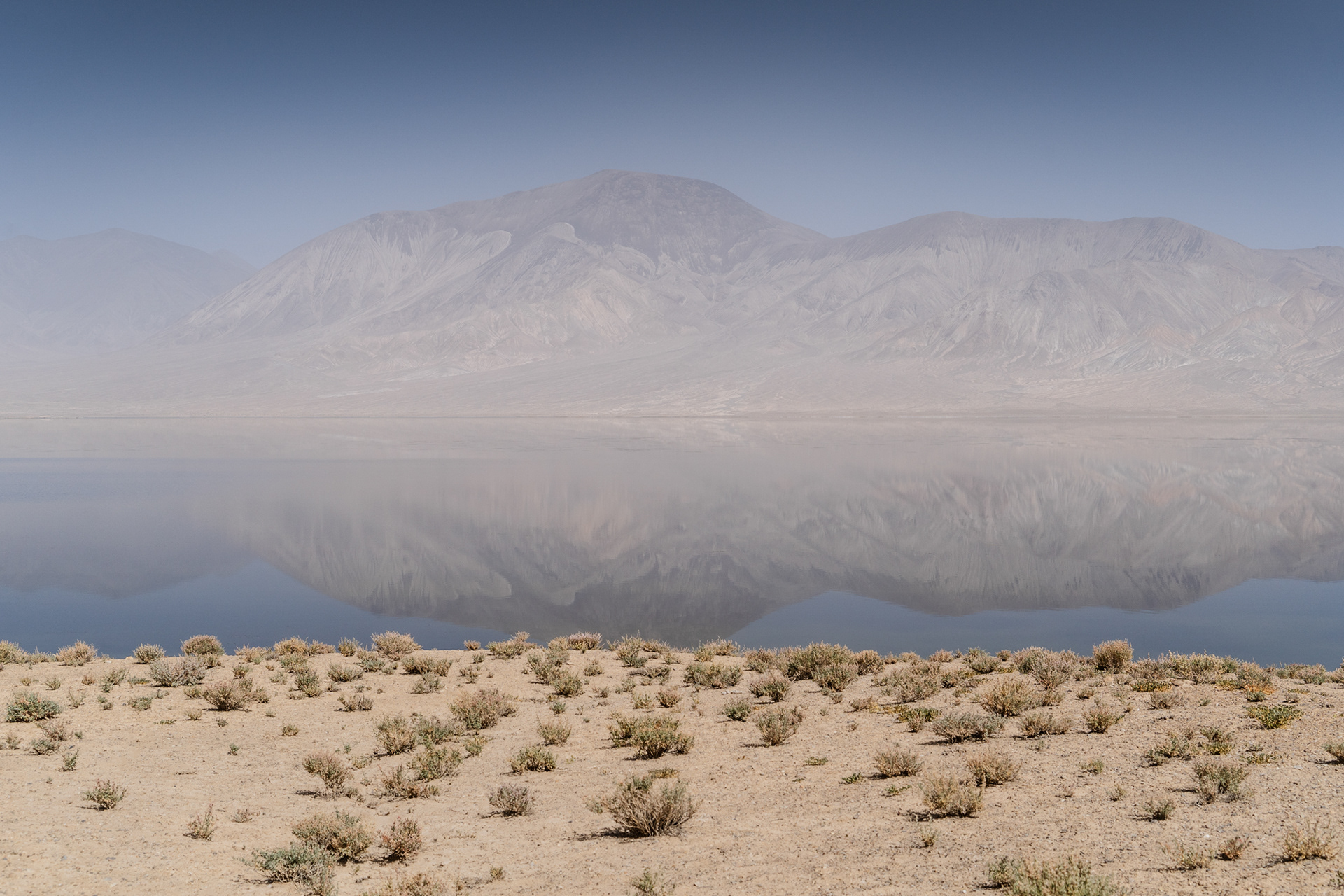
Shorkul Lake
Shorkul Lake
Looking East, into the Greater Pamir
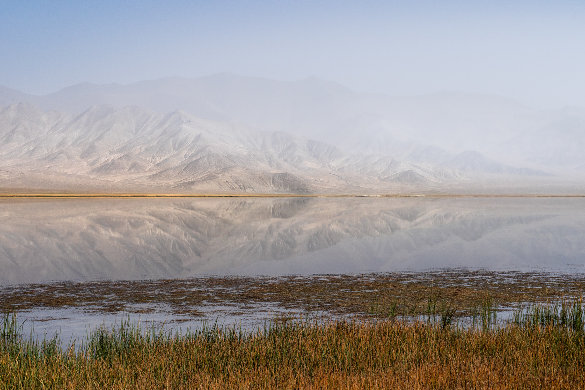
Rangkul Lake
Rangkul Lake
A colourful grassy landscape with jagged peaks and a lake in a hazy sky.

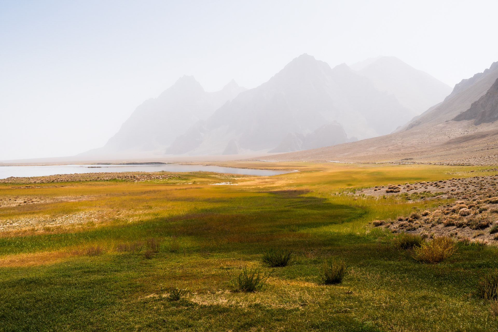
Looking back towards the lake, the landscape still engulfed in the fog, we said goodbye to Rangkul and drove back towards the M41.

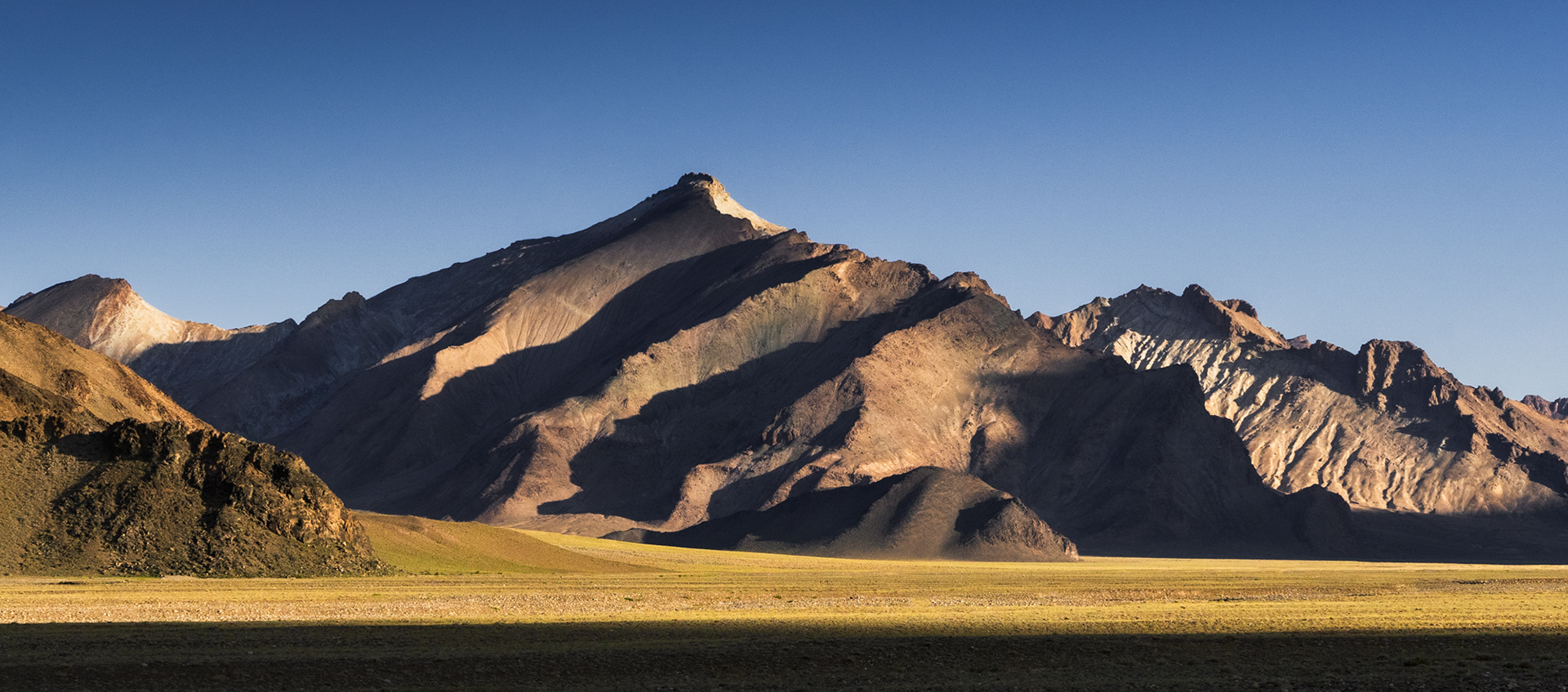
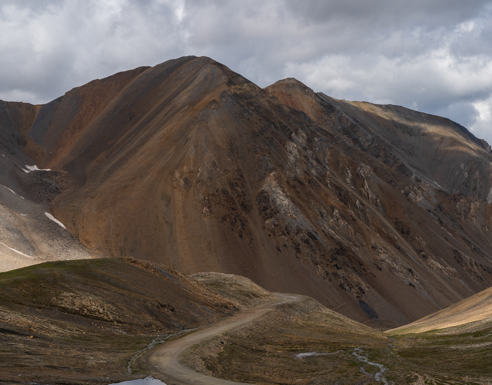
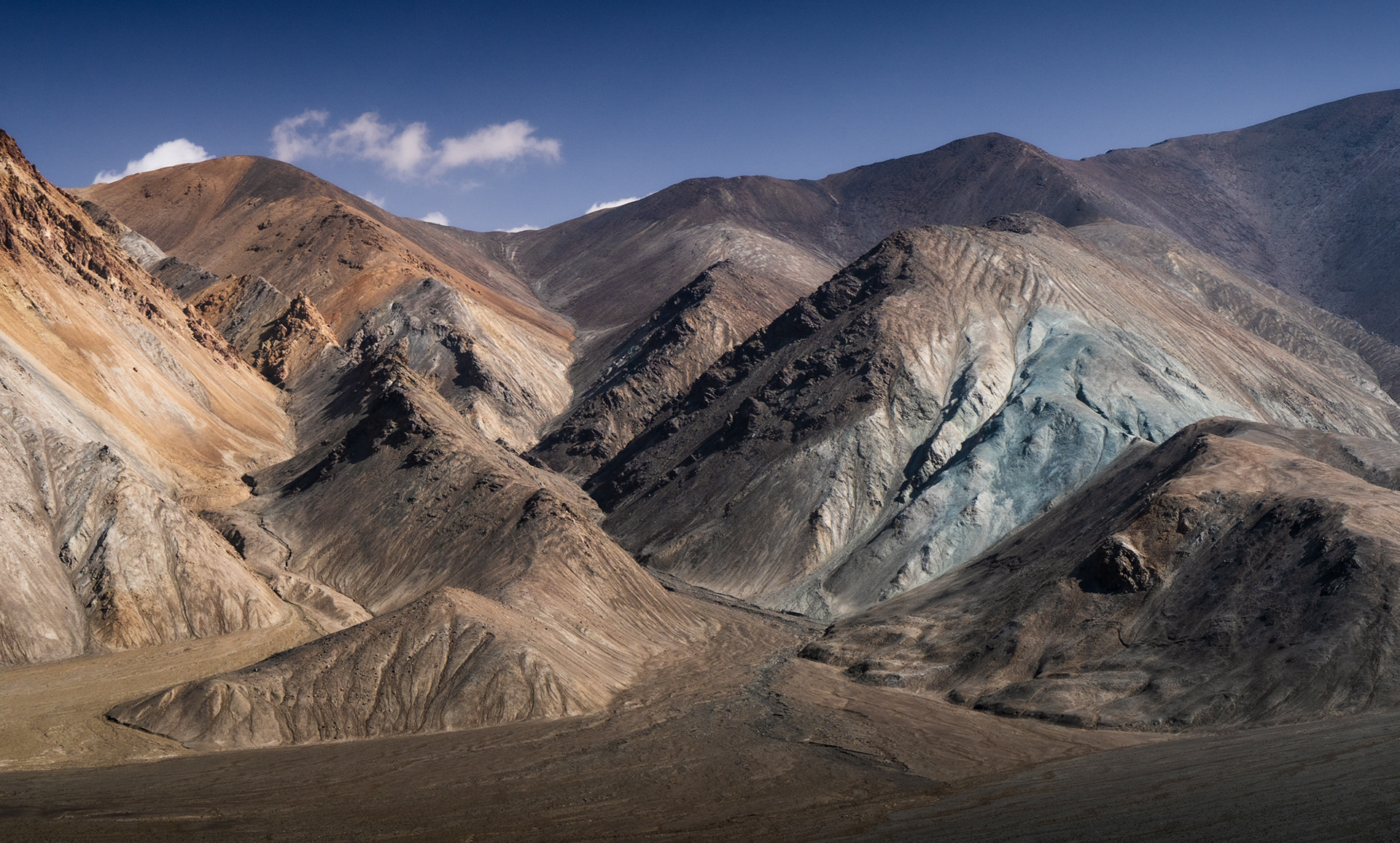
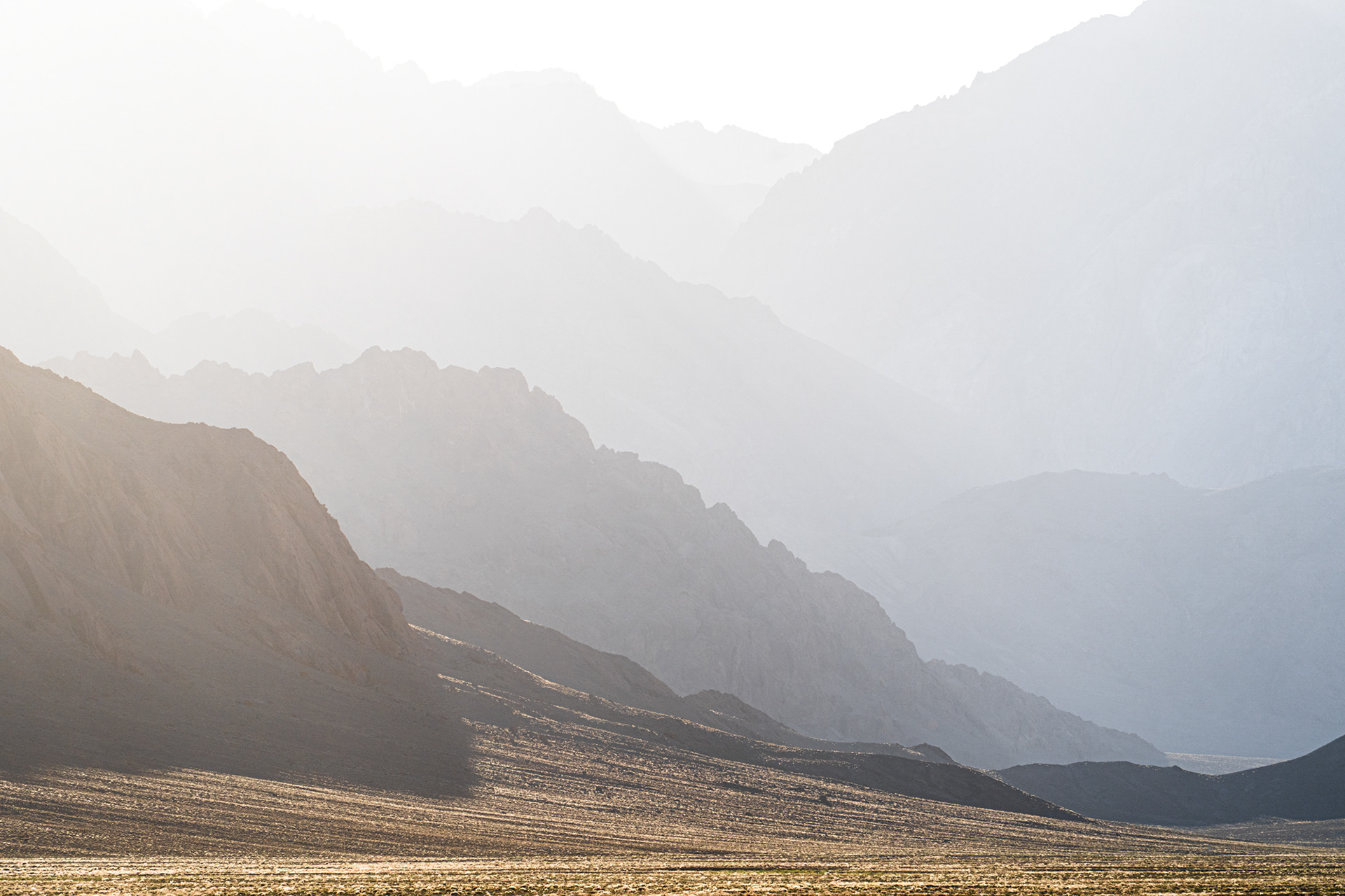
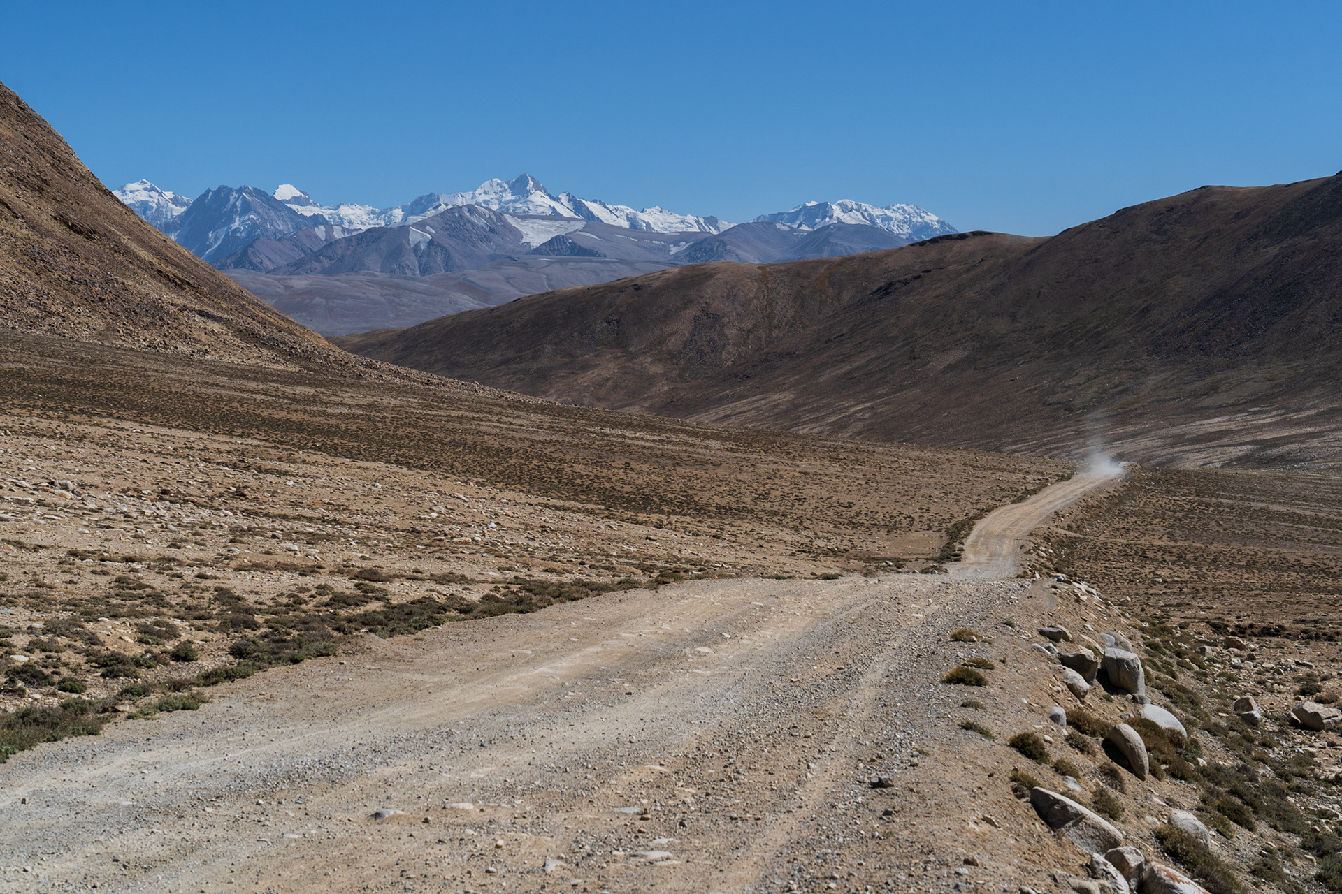
Driving North from Murghob, landscapes like this are typical: flat valley beds, and jagged, layered mountains.

A rugged road through a barren, mountainous landscape in Tajikistan.

Descending North from the Ak-Baital Pass, the highest point on the Pamir Highway. at 4,655m.

Sun hitting coloured and layered mountains in Pamir.

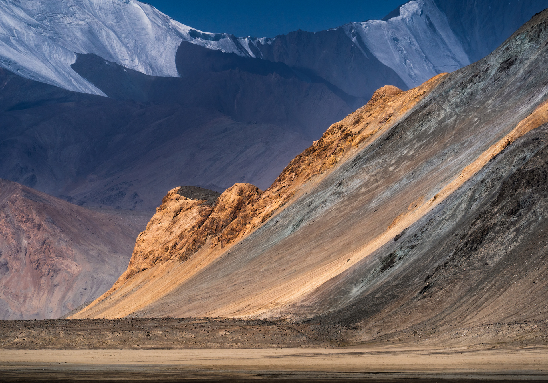
The heavy, high altitude sun hits the parched, layered landscape.

A border fence and snowy mountains in Pamir.

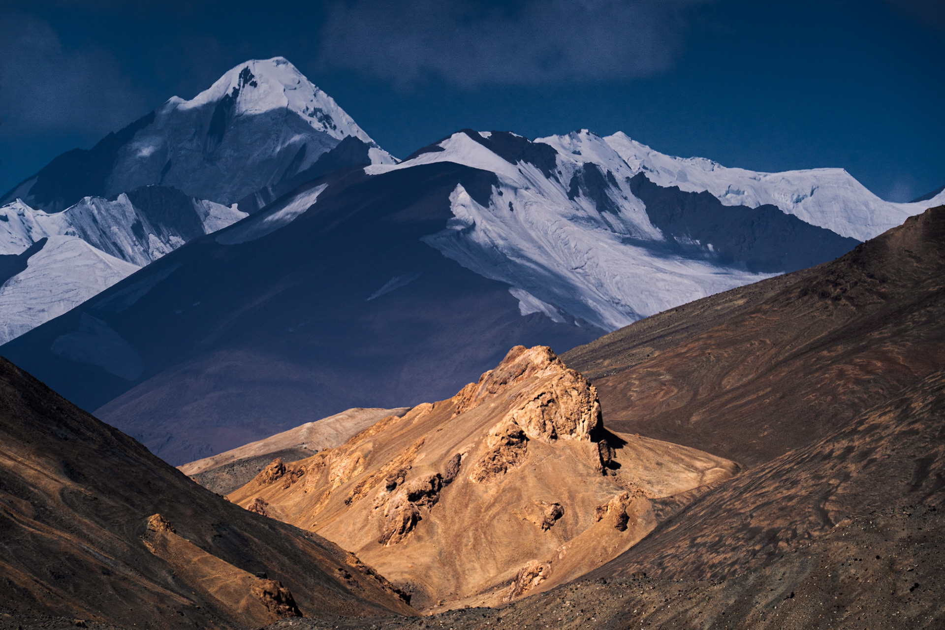
Although China is still more than ten kilometres away (the snowy peaks in the distance lie on the border), the military border is just metres away from the Pamir Highway.

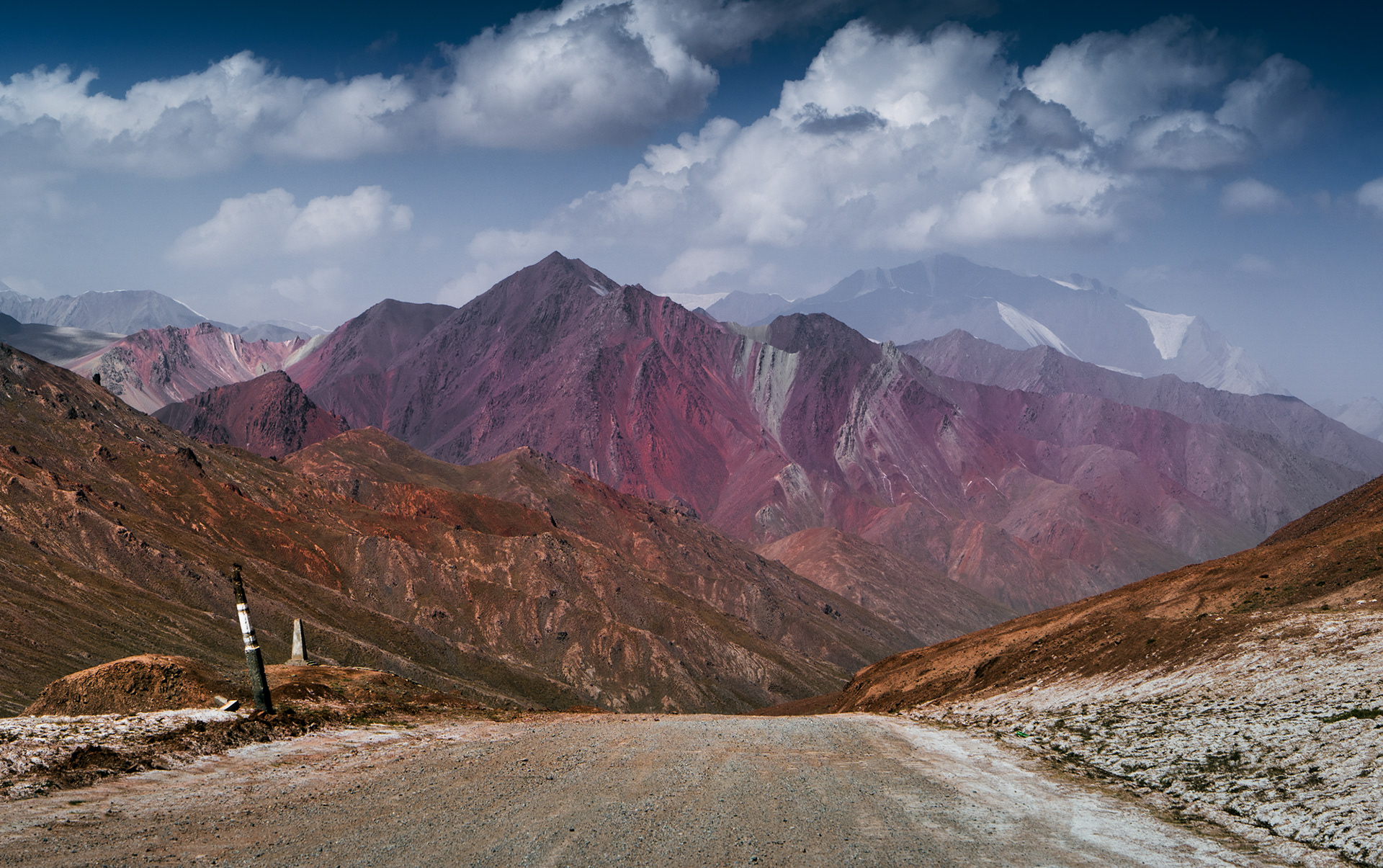
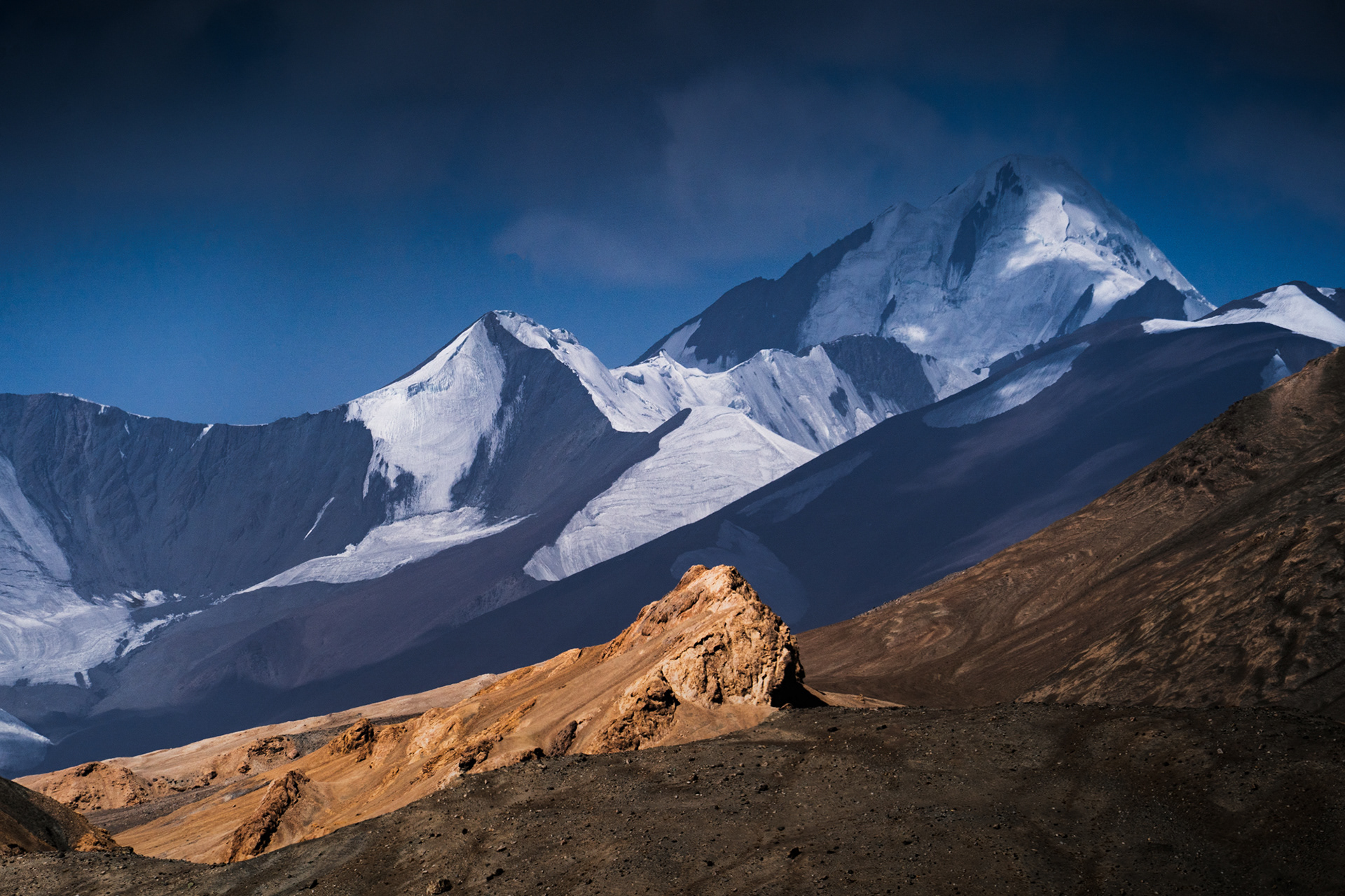
Standing at the top of the pass, Tajikistan behind, no-man's land in front. Somewhere in 20 kilometres, Kyrgyzstan awaits.
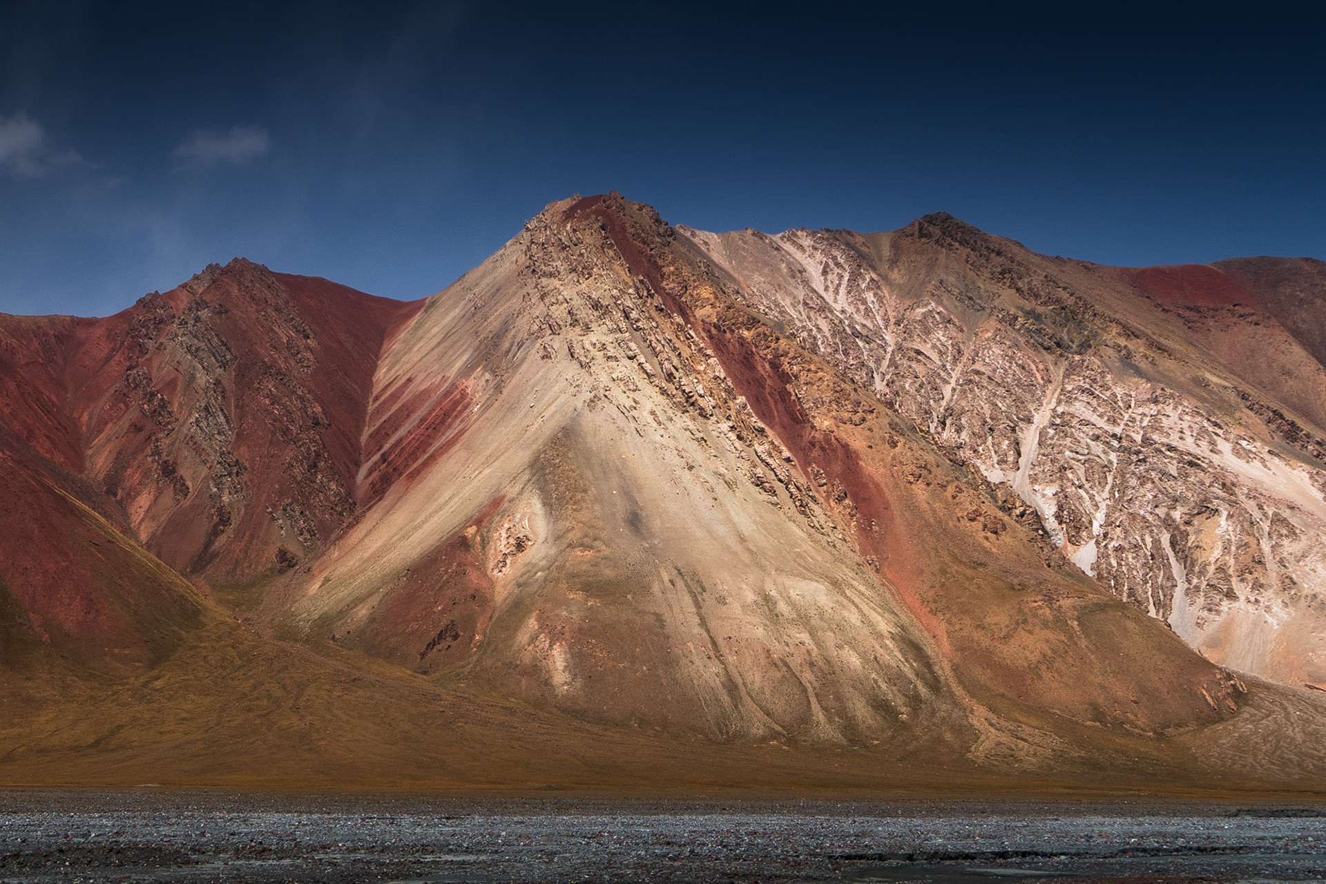
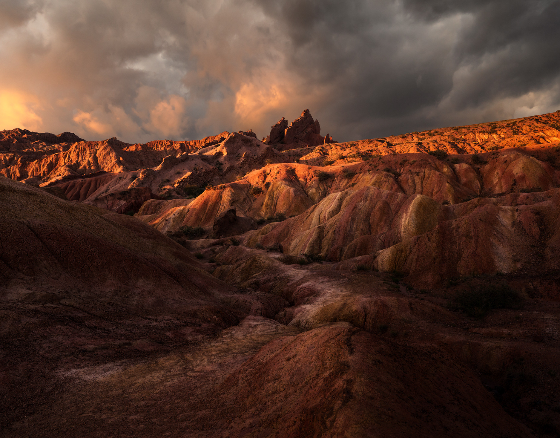
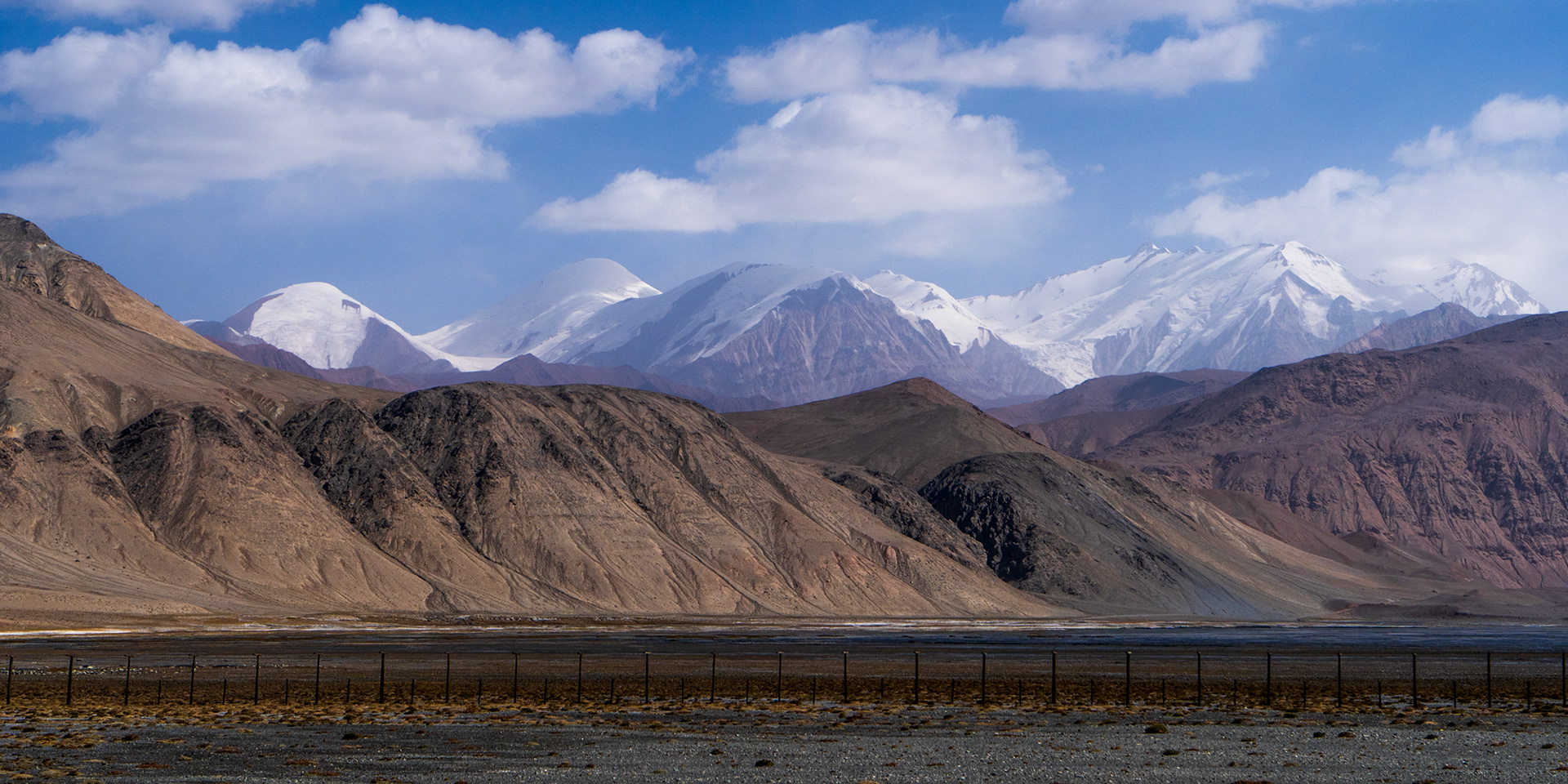
Colourful layers of the no-man's land, after descending 1,000 from Tajikistan.
Closer to the Kyrgyz border, the coloured Alay mountains welcome us.
Photo of Gora Kurumdy, with strong light and shadow on the snow and ice.

The North Face of Gora Kurumdy, the 6,614m tri-border point between Kyrgyzstan, Tajikistan, and China.

You may also like

Back to Top